Testing Sep 2025
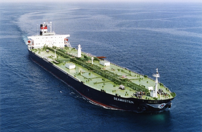
Kabler, rørledninger, veje, søstræde, luftruter og satellitter udgør det skrøbelige netværk, som den globale økonomi er bygget på. Det er usynlige netværk af enorm betydning for den globale forsyningskæde og det moderne liv, som dog kun huskes, når en krig som den i Ukraine eller Israel truer en af disse strategiske […]
DEEPSEA: næste generations rejseoptimering drevet af Artificial Intelligence (AI) Brug Artificial Intelligence (AI) Performance Routing til øjeblikkeligt at accelerere din flådes dekarboniseringsbane og reducere brændstofomkostningerne. Performance Routing vil have en stor, kvantificerbar indflydelse på din flådes brændstofforbrug og CII i dag, resultater med stor effekt fra dag ét. “DeepSea Vessel Voyage Optimization AI Solution reducerer emissioner, […]
World's most famous Luxurious Marinas: Which are the most luxurious and popular marinas worldwide? Portofino, Monaco, St. Tropez, Ibiza, St. Barts. One of the first images that comes to mind when we think of these places are their iconic marinas. Dignitaries, powerful people of wealth, glamorous Hollywood stars and all those who have made yachting […]
Fishing is changing for the good of the Earth - advanced bio-based plastic solutions (By Tassoula Eptakili - www.kathimerini.gr) Almost 12 million tons of plastic waste end up in the world's oceans every year. Sometimes they travel in the water, creating huge underwater garbage dumps, and sometimes they come ashore. The effects of mindless consumption […]
Google - Data Centers Through 2022, Google has strengthened its commitment in Greece to accelerate sustainable and inclusive development and digital transformation, further intensifying its substantial support to the country. With strategic initiatives, and with a focus on people, the technology company opened a new important chapter in Greece with the announcement of the creation […]
Lloyd's List's One Hundred People, rangordnede indflydelse og magt inden for skibsfarten Individuelle handlinger har stadig betydning i skibsfarten, selvom skibsejeres magt er ved at aftage. Alligevel er dette års afgørende øjeblik kommet fra EU, som har overhalet IMO som den mest indflydelsesrige kraft i branchen, ved at tage håndgribelige foranstaltninger til at håndtere klimaforandringer, IT […]
UKHO announced intention to end Paper Nautical Chart production (26 July 2022) (source: UK Hydrographic Office) The UK Hydrographic Office (UKHO) has announced on 26 July 2022 its intention to develop options for the withdrawal from global paper nautical chart production by late 2026 to increase focus on its digital navigation products and services. ("UKHO […]
Lige siden folk begyndte at bygge komplicerede ting, indså de, at der var behov for et målesystem. Oprindeligt var grundlaget den menneskelige krop. Det revolutionære Frankrig skulle producere, hvad der udviklede sig til det definitive internationale system af enheder (internationalt målesystem). Egypterne brugte alen, der var omkring 52,4 centimeter, men fordi […]
Arcadia Shipmanagement's Aegean Myth blev anerkendt af DNV som det første verificerede SEEMP III fartøjsklassifikationsselskab DNV overrakte Arcadia Shipmanagement Co Ltd et certifikat, der anerkendte deres fartøj Aegean Myth som det første skib globalt, der havde en SEEMP III manual. Ship Operational Carbon Intensity Plan eller SEEMP Part III er en del af […]
Fra august 2022 vil de flyvende delfiner fra Hellenic Seaways, som har transporteret snesevis, hvis ikke hundredvis af millioner af græske og udenlandske passagerer i Argosaronicos bugten i løbet af de sidste fem årtier, gå over i historien. Associeret i opfattelsen af de fleste som støjende, men hurtige køretøjer til sommer og ikke kun flugter, hovedsageligt i Argosaronicos, […]
(Marine Shipping Glossary terms are offered by Hellenic Shipping News) press CTRL + F in your web browser to pop up the Search Bar and type the term you want to find... Maritime Dictionary app in Google Play Maritime Dictionary App Marine (app) in google Play Shipping Dictionary (app) in Google Play Naval Terms Dictionary […]
Kortrettelser og opdateringer Gamle, ikke-opdaterede (siden endda få uger) søkort bør aldrig bruges til maritim navigation og rejseplanlægning. Specielt karakteristikaene for en flod, der er portrætteret på et søkort, har tendens til at ændre sig løbende, og kunstige navigationshjælpemidler til søs eller kyster kan ændres til enhver tid. Som en […]
NOAA's Nautical Paper Charts (Raster Nautical Charts: both paper and digital Raster Charts) will soon not be produced any more (by 2025) On April 13, the US federal government's National Oceanic & Atmospheric Administration (NOAA) announced it will soon stop printing traditional lithographic (paper) nautical charts - while other forms of nautical charts, such as […]
Webkorttjenester (sammenligning) Mest populære webkorttjenester Google Maps Bing Maps MapQuest OpenStreetMap Her WeGo Apple Maps Yandex Maps Sammenligningsliste Funktion Google Maps Bing Maps MapQuest OpenStreetMap Her WeGo Apple Maps Yandex Maps Licens Proprietær Proprietær Proprietær ODbL proprietært ekstra proprietær tilgængelighed Fuld proprietær tilgængelighed Australien, Canada, Kina, Frankrig, Tyskland, Israel, Italien, […]
A catalog of free (not necessarily Open Source) Satellite Navigation (or "GPS") software for a wide range of devices. (Navigation software with free maps - often uses maps from OpenStreetMap project) Satellite Navigation Software- Non-free maps Name Company Type of device[5] Operating system 3rd-party GPS-able?[6] Software with maps? Follows streets? Open-source? Remarks Aqua Map[29] GEC […]
hvad er forkortelserne, der bruges i søkort (Admiralitetskort / Søkort) Bundkarakteristika og forkortelser Navneord Kildekort Navneord Forkortelse Forkortelse Boulders Blds Blds Clay Cl Cy Coral Co Co Coralhead Cl Hd Cl Hd Grus GG Grass MM Grs Grs Mud […]
Filipinos: major source of Seafarers for the global maritime sector - One third of the world's seafarers are Filipinos. In the 1970s, the number of seafarers in traditional maritime countries dropped, resulting in a transfer of supply to countries such as India, China, and the Philippines. The Philippines has developed to become a significant producer […]
En sofistikeret ny portal for søkort og publikationer er blevet lanceret, der ikke har noget abonnement eller minimumskontraktperiode, og gratis opdateringer og rettelser. OpenC247.com reagerer på den stigende efterspørgsel efter digitale teknologier i den maritime sektor. Den bløde lancering af portalen har tiltrukket mere end 150 registrerede brugere, fra kaptajner på super […]
European Digital Twin of the Ocean (European DTO) This tool will model the ocean and provide knowledge and understanding of the past and present and will create credible predictions of the ocean's future health. The ILIAD consortium will develop virtual representations of the sea that will integrate earth observing, modelling and digital infrastructures to provide […]
What is the Differences between VECTOR and RASTER Graphics? (right below its treated the difference Raster/Vector in regards to graphics - look further below for the difference between Vector Nautical Charts (VNC) and Raster Nautical Charts (RNC)) There is some confusion to many people when it comes to the differences between vector and raster graphics. […]
(* source: www.sailingissues.com - by Diederik Willemsen) Marine Navigation courses (FREE) Find advanced online course on marine navigation for offshore sailing. All though nowadays most sailors rely on maritime navigation and positioning equipment like the use of GPS / Galileo / GLONASS and Radars to navigate, by navigating by yourself is a lot more fun, Learn navigation to sail […]
(* source: NOAA - the National Oceanic and Atmospheric Administration (USA), the American scientific and regulatory agency - Symbols, Abbreviations and Terms used on Paper and Electronic Nautical Charts ENCs) Paper and Electronic Navigational Charts: Symbols, Abbreviations and Terms used on Marine Navigation Charts see a full list of symbols used on paper nautical charts […]
GLOSSARY of Nautical Charts, terms & abbreviations used in the maritime industry (* source: NOAA - the National Oceanic and Atmospheric Administration (USA), the American scientific and regulatory agency) An authoritative source for terms used in cartography (mapping), marine charting, and geodesy used in the nautical charting program. Terms and definitions are of specific cartographic […]
Find alle topudbydere af Marine Navigation-produkter og -tjenester til sikker sørejseplanlægning