Testing Sep 2025
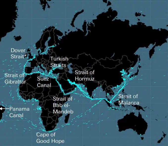
Kaapelit, putkistot, tiet, merisalmet, lentoreitit ja satelliitit muodostavat herkän verkon, jolle maailmantalous on rakennettu. Nämä ovat globaalille toimitusketjulle ja nykyelämälle suunnattoman tärkeitä näkymättömiä verkostoja, jotka kuitenkin muistetaan vasta, kun Ukrainan tai Israelin kaltainen sota uhkaa jotakin näistä strategisista […]
DEEPSEA: uuden sukupolven matkojen optimointi, joka perustuu tekoälyyn (AI) Käytä tekoälyn (AI) suorituskykyreititystä nopeuttaaksesi välittömästi laivastosi hiilidioksidipäästöjen vähentämistä ja alentaaksesi polttoainekustannuksia. Suorituskyvyn reitityksellä on merkittävä, mitattavissa oleva vaikutus kalustosi polttoaineenkulutukseen ja CII:hen tänään, ja tulokset ovat suuria ensimmäisestä päivästä lähtien. ”DeepSea Vessel Voyage Optimization AI -ratkaisu vähentää päästöjä, […]
World's most famous Luxurious Marinas: Which are the most luxurious and popular marinas worldwide? Portofino, Monaco, St. Tropez, Ibiza, St. Barts. One of the first images that comes to mind when we think of these places are their iconic marinas. Dignitaries, powerful people of wealth, glamorous Hollywood stars and all those who have made yachting […]
Fishing is changing for the good of the Earth - advanced bio-based plastic solutions (By Tassoula Eptakili - www.kathimerini.gr) Almost 12 million tons of plastic waste end up in the world's oceans every year. Sometimes they travel in the water, creating huge underwater garbage dumps, and sometimes they come ashore. The effects of mindless consumption […]
Google - Data Centers Through 2022, Google has strengthened its commitment in Greece to accelerate sustainable and inclusive development and digital transformation, further intensifying its substantial support to the country. With strategic initiatives, and with a focus on people, the technology company opened a new important chapter in Greece with the announcement of the creation […]
Lloyd's List's Sata ihmistä, sijoittuva vaikutus ja valta merenkulussa Yksittäiset toimet ovat edelleen tärkeitä merenkulussa, vaikka laivanomistajien valta on hiipumassa. Tämän vuoden ratkaiseva hetki on kuitenkin tullut EU:lta, joka on ohittanut IMO:n alan vaikutusvaltaisimpana voimana ryhtymällä konkreettisiin toimiin ilmastonmuutoksen torjumiseksi IT […]
UKHO announced intention to end Paper Nautical Chart production (26 July 2022) (source: UK Hydrographic Office) The UK Hydrographic Office (UKHO) has announced on 26 July 2022 its intention to develop options for the withdrawal from global paper nautical chart production by late 2026 to increase focus on its digital navigation products and services. ("UKHO […]
Siitä lähtien, kun ihmiset alkoivat rakentaa monimutkaisia asioita, he ymmärsivät, että mittausjärjestelmää tarvitaan. Alunperin perusta oli ihmiskeho. Vallankumouksellisen Ranskan oli tarkoitus tuottaa se, mikä kehittyi lopulliseksi kansainväliseksi yksikköjärjestelmäksi (International Measurement System). Egyptiläiset käyttivät kyynärää, joka oli noin 52,4 senttimetriä, mutta koska […]
DNV tunnusti Arcadia Shipmanagementin Aegean Mythin ensimmäiseksi varmennetuksi SEEMP III -alukseksi Luokitusyhtiö DNV myönsi Arcadia Shipmanagement Co Ltd:lle todistuksen, jossa tunnustetaan heidän aluksensa Aegean Myth ensimmäisenä aluksena maailmanlaajuisesti, jolla on SEEMP III -opas. Aluksen toiminnan hiili-intensiteettisuunnitelma eli SEEMP Part III on osa […]
Elokuusta 2022 lähtien Hellenic Seawaysin lentävät delfiinit, jotka kuljettivat Argosaronicosin lahdella viimeisten viiden vuosikymmenen aikana kymmeniä, ellei satoja miljoonia kreikkalaisia ja ulkomaisia matkustajia, jäävät historiaan. Liittyy useimpien mielestä meluisiksi, mutta nopeiksi kesäajoneuvoksi eikä vain pakenemiseen, pääasiassa Argosaronicosissa, […]
(Marine Shipping Glossary terms are offered by Hellenic Shipping News) press CTRL + F in your web browser to pop up the Search Bar and type the term you want to find... Maritime Dictionary app in Google Play Maritime Dictionary App Marine (app) in google Play Shipping Dictionary (app) in Google Play Naval Terms Dictionary […]
Karttakorjaukset ja päivitykset Vanhat, päivittämättömät (jopa muutaman viikon jälkeen) Merikarttoja ei tule koskaan käyttää merenkulun navigointiin ja matkan suunnitteluun. Erityisesti merikartassa kuvatut joen ominaisuudet pyrkivät muuttumaan jatkuvasti, ja merellä tai rannoilla olevia keinotekoisia navigointilaitteita voidaan muuttaa milloin tahansa. Kuten […]
NOAA's Nautical Paper Charts (Raster Nautical Charts: both paper and digital Raster Charts) will soon not be produced any more (by 2025) On April 13, the US federal government's National Oceanic & Atmospheric Administration (NOAA) announced it will soon stop printing traditional lithographic (paper) nautical charts - while other forms of nautical charts, such as […]
Verkkokarttapalvelut (vertailu) Suosituimmat verkkokarttapalvelut Google Maps Bing Maps MapQuest OpenStreetMap Here WeGo Apple Maps Yandex Maps Vertailuluettelo Ominaisuus Google Maps Bing Maps MapQuest OpenStreetMap Täällä WeGo Apple Maps Yandex Maps Lisenssi Omistusoikeus Oomistusoikeus Omistusoikeus Omistusoikeus Omistusoikeus Omistusoikeus Omistusoikeus Omistusoikeus Omistusoikeus Omistusoikeus Australia, Kanada, Kiina, Ranska, Saksa, Israel, Italia, […]
A catalog of free (not necessarily Open Source) Satellite Navigation (or "GPS") software for a wide range of devices. (Navigation software with free maps - often uses maps from OpenStreetMap project) Satellite Navigation Software- Non-free maps Name Company Type of device[5] Operating system 3rd-party GPS-able?[6] Software with maps? Follows streets? Open-source? Remarks Aqua Map[29] GEC […]
mitä lyhenteitä käytetään merikartoissa (Admiralty Charts / Maritime Charts) Pohjaominaisuudet ja lyhenteet Substantiivit Lähdekartta Substantiivilyhenne Lyhenne Boulders Blds Blds Clay Mu Grs Cy Coral Co Co Coralhead Cl GG Cl Hd Gravels
Filipinos: major source of Seafarers for the global maritime sector - One third of the world's seafarers are Filipinos. In the 1970s, the number of seafarers in traditional maritime countries dropped, resulting in a transfer of supply to countries such as India, China, and the Philippines. The Philippines has developed to become a significant producer […]
Merikarttojen ja julkaisujen hienostunut uusi portaali on avattu, jossa ei ole tilausta tai vähimmäissopimusehtoa sekä ilmaisia päivityksiä ja korjauksia. OpenC247.com vastaa digitaalisten teknologioiden kasvavaan kysyntään merenkulkualalla. Portaalin pehmeä käynnistäminen on houkutellut yli 150 rekisteröitynyttä käyttäjää super […]
European Digital Twin of the Ocean (European DTO) This tool will model the ocean and provide knowledge and understanding of the past and present and will create credible predictions of the ocean's future health. The ILIAD consortium will develop virtual representations of the sea that will integrate earth observing, modelling and digital infrastructures to provide […]
What is the Differences between VECTOR and RASTER Graphics? (right below its treated the difference Raster/Vector in regards to graphics - look further below for the difference between Vector Nautical Charts (VNC) and Raster Nautical Charts (RNC)) There is some confusion to many people when it comes to the differences between vector and raster graphics. […]
(* source: www.sailingissues.com - by Diederik Willemsen) Marine Navigation courses (FREE) Find advanced online course on marine navigation for offshore sailing. All though nowadays most sailors rely on maritime navigation and positioning equipment like the use of GPS / Galileo / GLONASS and Radars to navigate, by navigating by yourself is a lot more fun, Learn navigation to sail […]
(* source: NOAA - the National Oceanic and Atmospheric Administration (USA), the American scientific and regulatory agency - Symbols, Abbreviations and Terms used on Paper and Electronic Nautical Charts ENCs) Paper and Electronic Navigational Charts: Symbols, Abbreviations and Terms used on Marine Navigation Charts see a full list of symbols used on paper nautical charts […]
GLOSSARY of Nautical Charts, terms & abbreviations used in the maritime industry (* source: NOAA - the National Oceanic and Atmospheric Administration (USA), the American scientific and regulatory agency) An authoritative source for terms used in cartography (mapping), marine charting, and geodesy used in the nautical charting program. Terms and definitions are of specific cartographic […]
Löydä kaikki merinavigointituotteiden ja -palveluiden parhaat toimittajat turvalliseen merimatkasuunnitteluun