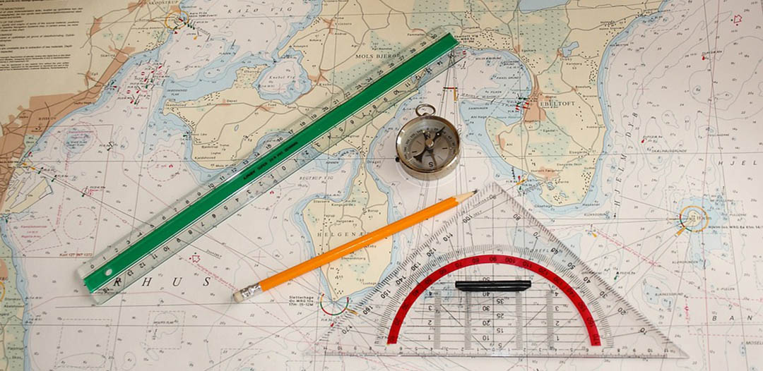
Por que as cartas marítimas precisam ser atualizadas? Cartas náuticas são documentos "vivos". As informações que afetam a segurança da navegação dos marinheiros são constantemente sendo recebido. Às vezes, é na forma de um relatório individual de um recém-formado perigo descoberto, ou uma bóia ou farol foi movido ou removido, enquanto outras vezes a mudança pode ser tão grande quanto um pesquisa totalmente nova. Em todos os casos, os vários Institutos Hidrográficos nacionais têm a obrigação de publicar detalhes de novos e alterados informações que afetam o potencial segurodade de marinheiros. Da mesma forma, muitos marinheiros têm a obrigação legal de para aplicar essas atualizações às suas cartas náuticas – ter suas cartas de navegação marítima atualizadasaté o momento é muito mais do que uma boa ideia na verdade para todas as embarcações, desde grandes navios de carga até iates de corridaaltura.
As cartas náuticas são emitidas por força dos escritórios hidrográficos nacionais em muitos países. Essas cartas são consideradas "oficiais", ao contrário daquelas produzidas por editoras comerciais. Muitos escritórios hidrográficos fornecem atualizações manuais regulares, às vezes semanais, de suas cartas por meio de seus agentes de vendas.
A correção e a atualização de uma carta de navegação são processos constantes. Uma vez publicada, recursos e auxílios à navegação em constante mudança, ou outras informações relevantes, precisam ser promulgados para atualizar os navios que navegam nessas áreas.
Cartas náuticas atualizadas são obviamente importantes para fornecer segurança de navegação a todos os usuários finais

seleção de soluções de correções e atualizações de cartas náuticas de fornecedores premium em todo o mundo. Um serviço crítico para o planejamento de passagens seguras em qualquer lugar do mundo marítimo















Fornece inteligência geoespacial marítima global em apoio aos objetivos de segurança nacional, incluindo segurança da navegação, obrigações internacionais: Avisos aos Navegantes, Publicações, Avisos de Navegação, Pirataria, Catálogos de Produtos Marítimos, Calculadoras Náuticas... https://msi.nga.mil/

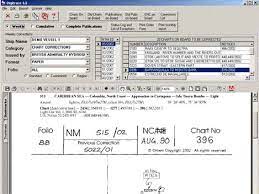
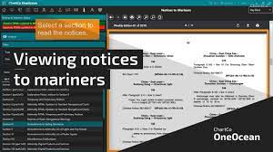

As características mostradas nos mapas mudam, seja por serem artificiais ou devido a mudanças naturais. Portanto, é essencial que nossos mapas sejam corrigido, ou atualizado regularmente.
A situação no mar muda constantemente. O Serviço Hidrográfico monitora as mudanças e publica as correções necessárias em suas publicações, a fim de informar os navegantes sobre a situação atual. Para isso, ele emite Avisos aos navegantes.
Aplicação de correções em cartas e publicações náuticas - Avisos aos Navegantes (NtM): você pode manter seus mapas e publicações náuticas atualizados usando os lançamentos frequentes de Avisos aos Navegantes produzidos pelos vários Escritórios Hidrográficos nacionais ou editoras comerciais.
Avisos aos Navegantes (NtM) são correções de cartas náuticas e publicações. As NtM contêm apenas informações de vital importância para a segurança no mar. Os navegantes são obrigados a manter seus produtos atualizados com as NtM até que uma nova edição seja publicada. A aviso aos navegantes (NTM ou NOTMAR) aconselha os navegantes sobre assuntos importantes que afetam a segurança da navegação, incluindo novas informações hidrográficas, mudanças de canais e auxílios à navegação, além de outros dados importantes. Mais de 60 países que produzem cartas náuticas também produzem um aviso aos navegantes. Cerca de um terço delas são semanais, outro terço são bimestrais ou mensais, e o restante é emitido irregularmente, conforme a necessidade.
Várias maneiras de atualizar e manter corretas as Cartas Marítimas e Livros/Publicações Náuticas a bordo do seu navio:
Avisos semanais aos navegantes
Lista cumulativa de avisos aos navegantes
Resumo anual de avisos aos navegantes
Software e computador de correções de gráficos
Há um banco de dados offline e um software em uso a bordo dos navios, onde as correções são fornecidas na forma de anexos semanais por e-mail. Estes são usados para manter o banco de dados de correções de cartas atualizado, exatamente como a cópia impressa dos Avisos Semanais aos Navegantes.
Avisos de Navarea
Avisos Navtex
Um companheiro próximo do Aviso aos Navegantes é o Resumo das correçõesO Resumo é publicado em cinco volumes. Cada volume abrange uma parte importante da Terra, incluindo diversas regiões cartográficas e muitas sub-regiões. O Volume 5 também inclui cartas especiais e publicações corrigidas pelo Aviso aos Navegantes. Como os Resumos contêm correções cumulativas, qualquer carta, independentemente da data de impressão, pode ser corrigida com o volume apropriado do Resumo e todos os Avisos aos Navegantes subsequentes.
Veja detalhes em: https://www.marineinsight.com/marine-navigation/what-are-the-methods-to-update-navigation-charts-on-board-ships/



OPENC247 – a maneira mais inteligente de navegar!
PAPEL E CARTAS DIGITAIS E NÁUTICAS
Cartas Náuticas, Correções de Cartas e Publicações Marinhas
Sem assinatura. Sem compromisso. Flexibilidade Total - 24 horas por dia, 7 dias por semana
DISPONÍVEL ON-LINE 365/24/7 em QUALQUER DISPOSITIVO (mob, guia, área de trabalho)
Um novo conceito no acesso a Gráficos digitais e gráficos e publicações em papel para sua ponte.
Perfeito para todos os capitães de navios de lazer ou comerciais, de qualquer embarcação – desde um super iate até um super petroleiro
Você pode obter acesso imediato ao que precisa, sem assinatura ou complicações. Permaneça em conformidade, economize tempo e dinheiro.
Basta registrar-se (a inscrição é GRATUITA - Sem assinatura/sem taxas recorrentes), experimente o serviço GRATUITO, veja preços transparentes e pague on-line apenas pelas cartas náuticas que você usa. Além disso, as correções e atualizações dos gráficos compilados são totalmente gratuitas.


Encontre todos os principais fornecedores de produtos e serviços de navegação marítima para planejamento seguro de viagens marítimas