Testing Sep 2025
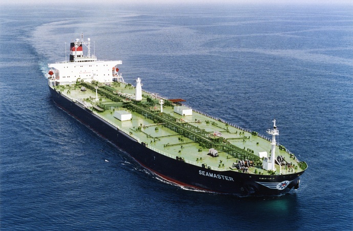
Dây cáp, đường ống, đường bộ, eo biển, đường hàng không và vệ tinh tạo thành mạng lưới mỏng manh mà nền kinh tế toàn cầu được xây dựng trên đó. Đây là những mạng lưới vô hình có tầm quan trọng to lớn đối với chuỗi cung ứng toàn cầu và cuộc sống hiện đại, tuy nhiên, chúng chỉ được nhớ đến khi một cuộc chiến như ở Ukraine hay Israel đe dọa một trong những […]
DEEPSEA: tối ưu hóa hành trình thế hệ tiếp theo được hỗ trợ bởi Trí tuệ nhân tạo (AI) Sử dụng Định tuyến hiệu suất trí tuệ nhân tạo (AI) để tăng tốc ngay lập tức quỹ đạo khử cacbon của đội tàu của bạn và giảm chi phí nhiên liệu. Định tuyến hiệu suất sẽ tạo ra tác động lớn, có thể định lượng được đối với mức tiêu thụ nhiên liệu và CII của đội xe của bạn ngày hôm nay, kết quả có tác động cao ngay từ ngày đầu tiên. “Giải pháp AI tối ưu hóa hành trình tàu biển sâu giúp giảm lượng khí thải, […]
World's most famous Luxurious Marinas: Which are the most luxurious and popular marinas worldwide? Portofino, Monaco, St. Tropez, Ibiza, St. Barts. One of the first images that comes to mind when we think of these places are their iconic marinas. Dignitaries, powerful people of wealth, glamorous Hollywood stars and all those who have made yachting […]
Fishing is changing for the good of the Earth - advanced bio-based plastic solutions (By Tassoula Eptakili - www.kathimerini.gr) Almost 12 million tons of plastic waste end up in the world's oceans every year. Sometimes they travel in the water, creating huge underwater garbage dumps, and sometimes they come ashore. The effects of mindless consumption […]
Google - Data Centers Through 2022, Google has strengthened its commitment in Greece to accelerate sustainable and inclusive development and digital transformation, further intensifying its substantial support to the country. With strategic initiatives, and with a focus on people, the technology company opened a new important chapter in Greece with the announcement of the creation […]
Một trăm người trong Danh sách của Lloyd, xếp hạng ảnh hưởng và quyền lực trong vận chuyển. Hành động của cá nhân vẫn quan trọng trong vận chuyển, ngay cả khi quyền lực của chủ tàu đang suy yếu. Tuy nhiên, thời điểm quyết định của năm nay lại đến từ EU, nơi đã vượt qua IMO để trở thành lực lượng có ảnh hưởng nhất trong ngành, bằng cách thực hiện hành động cụ thể để giải quyết vấn đề biến đổi khí hậu CNTT […]
UKHO announced intention to end Paper Nautical Chart production (26 July 2022) (source: UK Hydrographic Office) The UK Hydrographic Office (UKHO) has announced on 26 July 2022 its intention to develop options for the withdrawal from global paper nautical chart production by late 2026 to increase focus on its digital navigation products and services. ("UKHO […]
Kể từ khi con người bắt đầu xây dựng những thứ phức tạp, họ nhận ra rằng cần có một hệ thống đo lường. Ban đầu cơ sở là cơ thể con người. Nước Pháp cách mạng đã tạo ra thứ phát triển thành Hệ đơn vị quốc tế (Hệ thống đo lường quốc tế) Người Ai Cập sử dụng cubit khoảng 52,4 cm , nhưng vì […]
Huyền thoại Aegean của Arcadia Shipmanagement đã được DNV công nhận là tổ chức phân loại tàu SEEMP III được xác minh đầu tiên DNV đã trao cho Arcadia Shipmanagement Co Ltd giấy chứng nhận công nhận tàu Aegean Myth của họ là con tàu đầu tiên trên toàn cầu có sổ tay hướng dẫn SEEMP III. Kế hoạch cường độ carbon trong hoạt động của tàu hoặc SEEMP Phần III, là một phần của […]
Từ tháng 8 năm 2022, những con cá heo bay của Hellenic Seaways, nơi chở hàng chục, nếu không muốn nói là hàng trăm triệu hành khách Hy Lạp và nước ngoài ở vịnh Argosaronicos trong 5 thập kỷ qua, sẽ đi vào lịch sử. Liên quan đến nhận thức của hầu hết các phương tiện ồn ào nhưng nhanh chóng vào mùa hè và không chỉ chạy trốn, chủ yếu ở Argosaronicos, […]
(Marine Shipping Glossary terms are offered by Hellenic Shipping News) press CTRL + F in your web browser to pop up the Search Bar and type the term you want to find... Maritime Dictionary app in Google Play Maritime Dictionary App Marine (app) in google Play Shipping Dictionary (app) in Google Play Naval Terms Dictionary […]
Chỉnh sửa & Cập nhật Hải đồ Cũ, không cập nhật (thậm chí từ vài tuần) Không bao giờ nên sử dụng Hải đồ để điều hướng hàng hải và lập kế hoạch hành trình. Đặc biệt, các đặc điểm của một dòng sông được thể hiện trên hải đồ có xu hướng thay đổi liên tục và các thiết bị hỗ trợ dẫn đường nhân tạo trên biển hoặc ven bờ có thể bị thay đổi bất cứ lúc nào. Như một […]
NOAA's Nautical Paper Charts (Raster Nautical Charts: both paper and digital Raster Charts) will soon not be produced any more (by 2025) On April 13, the US federal government's National Oceanic & Atmospheric Administration (NOAA) announced it will soon stop printing traditional lithographic (paper) nautical charts - while other forms of nautical charts, such as […]
Dịch vụ bản đồ web (so sánh) Các dịch vụ bản đồ web phổ biến nhất Google Maps Bing Maps MapQuest OpenStreetMap Here WeGo Apple Maps Bản đồ Yandex Danh sách so sánh Tính năng Google Maps Bing Maps MapQuest OpenStreetMap Here WeGo Apple Maps Giấy phép Yandex Maps Độc quyền Độc quyền Độc quyền Độc quyền ODbL Độc quyền Độc quyền Tính khả dụng độc quyền Chức năng bổ sung đầy đủ Úc, Canada, Trung Quốc, Pháp, Đức, Israel, Ý, […]
A catalog of free (not necessarily Open Source) Satellite Navigation (or "GPS") software for a wide range of devices. (Navigation software with free maps - often uses maps from OpenStreetMap project) Satellite Navigation Software- Non-free maps Name Company Type of device[5] Operating system 3rd-party GPS-able?[6] Software with maps? Follows streets? Open-source? Remarks Aqua Map[29] GEC […]
các chữ viết tắt được sử dụng trong Hải đồ (Hải đồ Đô đốc / Hải đồ) Đặc điểm đáy và từ viết tắt Danh từ Biểu đồ nguồn Danh từ Viết tắt Viết tắt Boulders Blds Blds Clay Cl Cy Coral Co Co Coralhead Cl Hd Cl Hd Gravel GG Grass Grs Grs Mud MM […]
Filipinos: major source of Seafarers for the global maritime sector - One third of the world's seafarers are Filipinos. In the 1970s, the number of seafarers in traditional maritime countries dropped, resulting in a transfer of supply to countries such as India, China, and the Philippines. The Philippines has developed to become a significant producer […]
Một cổng thông tin mới phức tạp dành cho hải đồ và ấn phẩm hàng hải đã được ra mắt mà không cần đăng ký hoặc không có thời hạn hợp đồng tối thiểu cũng như cập nhật và chỉnh sửa miễn phí. OpenC247.com đáp ứng nhu cầu ngày càng tăng về công nghệ kỹ thuật số trong lĩnh vực hàng hải. Buổi ra mắt thử nghiệm của cổng thông tin đã thu hút hơn 150 người dùng đăng ký, từ thuyền trưởng của các siêu […]
European Digital Twin of the Ocean (European DTO) This tool will model the ocean and provide knowledge and understanding of the past and present and will create credible predictions of the ocean's future health. The ILIAD consortium will develop virtual representations of the sea that will integrate earth observing, modelling and digital infrastructures to provide […]
What is the Differences between VECTOR and RASTER Graphics? (right below its treated the difference Raster/Vector in regards to graphics - look further below for the difference between Vector Nautical Charts (VNC) and Raster Nautical Charts (RNC)) There is some confusion to many people when it comes to the differences between vector and raster graphics. […]
(* source: www.sailingissues.com - by Diederik Willemsen) Marine Navigation courses (FREE) Find advanced online course on marine navigation for offshore sailing. All though nowadays most sailors rely on maritime navigation and positioning equipment like the use of GPS / Galileo / GLONASS and Radars to navigate, by navigating by yourself is a lot more fun, Learn navigation to sail […]
(* source: NOAA - the National Oceanic and Atmospheric Administration (USA), the American scientific and regulatory agency - Symbols, Abbreviations and Terms used on Paper and Electronic Nautical Charts ENCs) Paper and Electronic Navigational Charts: Symbols, Abbreviations and Terms used on Marine Navigation Charts see a full list of symbols used on paper nautical charts […]
GLOSSARY of Nautical Charts, terms & abbreviations used in the maritime industry (* source: NOAA - the National Oceanic and Atmospheric Administration (USA), the American scientific and regulatory agency) An authoritative source for terms used in cartography (mapping), marine charting, and geodesy used in the nautical charting program. Terms and definitions are of specific cartographic […]
Tìm tất cả các nhà cung cấp sản phẩm và dịch vụ hàng hải hàng đầu để lập kế hoạch hành trình hàng hải an toàn