케이블, 파이프라인, 도로, 해협, 항공로 및 위성은 세계 경제를 구축하는 취약한 네트워크를 형성합니다. 이는 글로벌 공급망과 현대 생활에 엄청나게 중요한 보이지 않는 네트워크이지만, 우크라이나나 이스라엘과 같은 전쟁이 이러한 전략적 […]
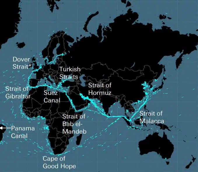
케이블, 파이프라인, 도로, 해협, 항공로 및 위성은 세계 경제를 구축하는 취약한 네트워크를 형성합니다. 이는 글로벌 공급망과 현대 생활에 엄청나게 중요한 보이지 않는 네트워크이지만, 우크라이나나 이스라엘과 같은 전쟁이 이러한 전략적 […]
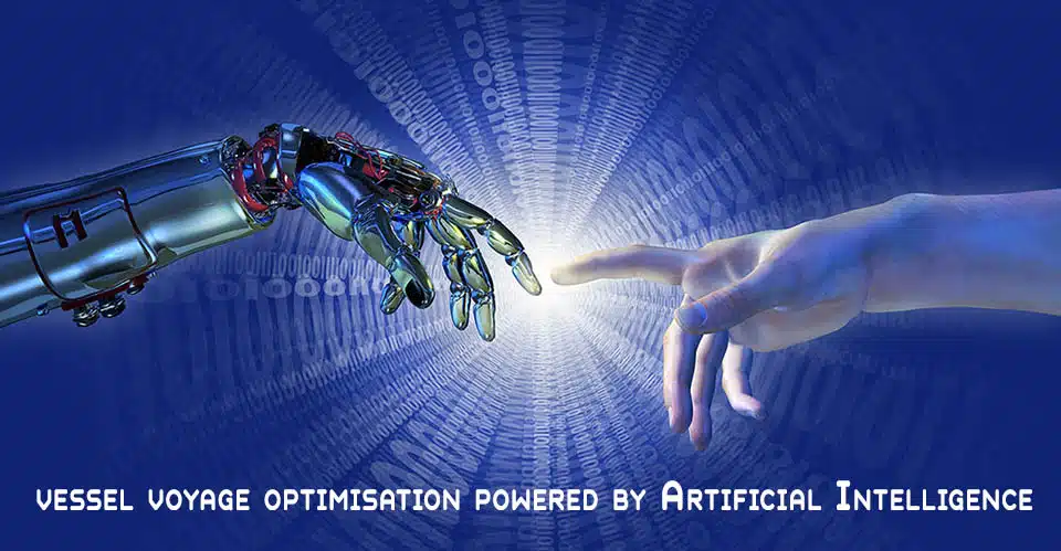
DEEPSEA: 인공 지능(AI)으로 구동되는 차세대 항해 최적화 인공 지능(AI) 성능 라우팅을 사용하여 함대의 탈탄소화 궤적을 즉시 가속화하고 연료 비용을 줄이십시오. Performance Routing은 차량의 연료 소비 및 CII에 정량화할 수 있는 중대한 영향을 미치며 첫날부터 큰 영향을 미치는 결과를 제공합니다. “심해 선박 항해 최적화 AI 솔루션은 배출량을 줄이고, […]
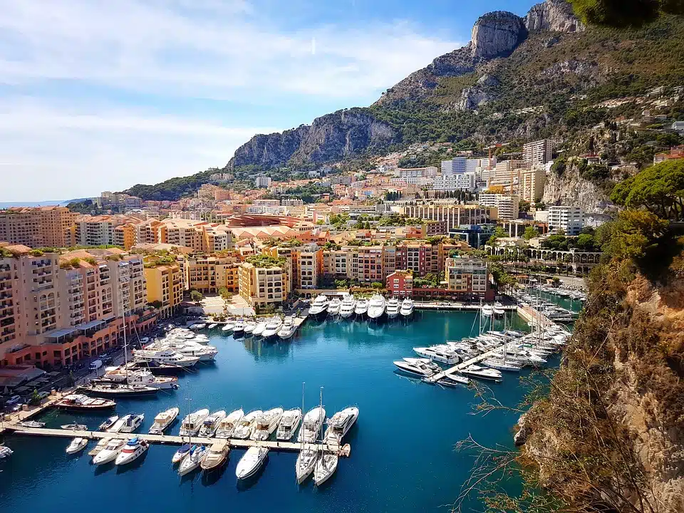
세계에서 가장 유명한 고급 마리나: 전 세계에서 가장 고급스럽고 인기 있는 마리나는 어디인가요? 포르토피노, 모나코, 생트로페, 이비자, 생바트. 이러한 장소를 생각할 때 가장 먼저 떠오르는 이미지 중 하나는 상징적인 정박지입니다. 고위 인사, 유력한 부자들, 화려한 할리우드 스타 및 요트를 만든 모든 사람들 […
어업은 지구의 이익을 위해 변화하고 있습니다 – 고급 바이오 기반 플라스틱 솔루션 (Tassoula Eptakili 작성 – www.kathimerini.gr) 매년 약 1,200만 톤의 플라스틱 폐기물이 전 세계 바다로 흘러갑니다. 때때로 그들은 물 속을 여행하여 거대한 수중 쓰레기 처리장을 만들고 때로는 해변으로옵니다. 무분별한 소비의 영향 […]
Google – 데이터 센터 2022년까지 Google은 그리스에서 지속 가능하고 포괄적인 개발 및 디지털 혁신을 가속화하겠다는 약속을 강화하여 국가에 대한 실질적인 지원을 더욱 강화했습니다. 전략적 이니셔티브와 사람에 중점을 둔 이 기술 회사는 창조 발표와 함께 그리스에서 새로운 중요한 장을 열었습니다. [...]

Lloyd's List의 100인, 해운 내 영향력과 권력 순위 선주들의 힘이 약해지고 있는 상황에서도 해운업에서는 여전히 개인의 행동이 중요합니다. 그러나 올해의 결정적인 순간은 기후 변화 IT를 해결하기 위해 실질적인 조치를 취함으로써 업계에서 가장 영향력 있는 힘으로 IMO를 추월한 EU에서 왔습니다. […]
UKHO, 종이 해도 생산 종료 의사 발표(2022년 7월 26일) (출처: UK Hydrographic Office) UK Hydrographic Office(UKHO)는 2022년 7월 26일 늦게까지 전 세계 종이 해도 생산 중단 옵션을 개발하겠다는 의사를 발표했습니다. 2026년 디지털 내비게이션 제품 및 서비스에 대한 집중도를 높입니다. (“욱호 […]
사람들이 복잡한 것을 만들기 시작한 이후로 그들은 측정 시스템이 필요하다는 것을 깨달았습니다. 원래 기초는 인체였습니다. 혁명적인 프랑스는 결정적인 국제 단위계(국제 측정 체계)로 진화한 것을 생산해야 했습니다. 이집트인들은 약 52,4센티미터인 큐빗을 사용했습니다.
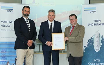
Arcadia Shipmanagement의 Aegean Myth는 DNV에서 검증된 최초의 SEEMP III 선박 분류 협회로 인정받았습니다. DNV는 Arcadia Shipmanagement Co Ltd의 선박 Aegean Myth가 SEEMP III 매뉴얼을 보유한 세계 최초의 선박임을 인정하는 인증서를 Arcadia Shipmanagement Co Ltd에 수여했습니다. Ship Operational Carbon Intensity Plan 또는 SEEMP Part III는 [...]의 일부입니다.
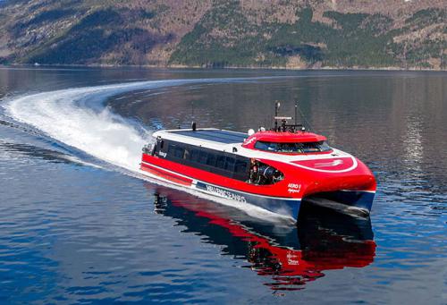
2022년 8월부터 지난 50년 동안 아르고사로니코스 만에서 수억 명은 아니더라도 수십 명의 그리스 및 외국인 승객을 태운 헬레닉 항로의 날아다니는 돌고래는 역사에 남을 것입니다. 주로 Argosaronicos에서 탈출뿐만 아니라 여름 동안 시끄럽지 만 빠른 차량으로 대부분의 인식과 관련하여 [...]
(Marine Shipping Glossary 용어는 Hellenic Shipping News에서 제공합니다.) 웹 브라우저에서 CTRL + F를 눌러 검색창을 띄우고 찾고자 하는 용어를 입력하세요… Google Play의 Maritime Dictionary 앱 Maritime Dictionary App Google의 Marine(앱) Google Play 해군 용어 사전에서 Play 해운 사전(앱) […
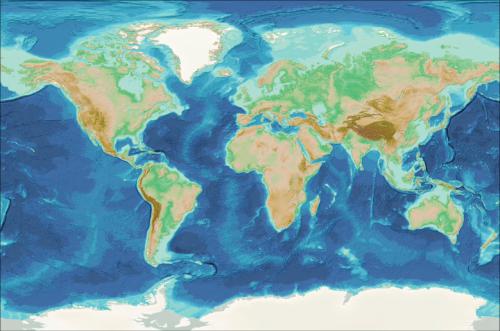
해도 수정 및 업데이트 오래되고 업데이트되지 않음(몇 주 후에도) 해상 해도는 해상 항해 및 항해 계획에 사용해서는 안 됩니다. 특히 해양지도에 묘사된 강의 특성은 지속적으로 변화하는 경향이 있으며, 바다나 해안의 인공항행장치는 언제든지 변경될 수 있습니다. […]
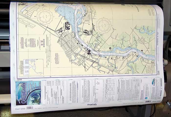
NOAA의 해상 종이 해도(Raster Nautical Charts: 종이 및 디지털 래스터 해도 모두)는 곧 더 이상 생산되지 않을 예정입니다(by 2025). 석판 인쇄(종이) 해도 – […]
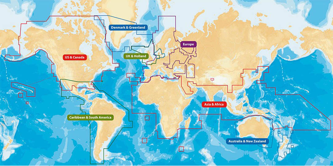
웹 지도 서비스(비교) 가장 인기 있는 웹 지도 서비스 Google Maps Bing Maps MapQuest OpenStreetMap Here WeGo Apple Maps Yandex Maps 비교 목록 기능 Google Maps Bing Maps MapQuest OpenStreetMap Here WeGo Apple Maps Yandex Maps License Proprietary Proprietary ODbL Proprietary Proprietary 가용성 전체 추가 기능 호주, 캐나다, 중국, 프랑스, 독일, 이스라엘, 이탈리아, […]
다양한 장치를 위한 무료(오픈 소스일 필요는 없음) 위성 항법(또는 "GPS") 소프트웨어 카탈로그. (무료 지도가 포함된 내비게이션 소프트웨어 – 종종 OpenStreetMap 프로젝트의 지도 사용) 위성 내비게이션 소프트웨어- 비자유 지도 이름 회사 장치 유형[5] 운영 체제 타사 GPS 가능?[6] 지도가 포함된 소프트웨어? 거리를 따라가나요? 오픈소스? 비고 아쿠아 맵[29] GEC […]
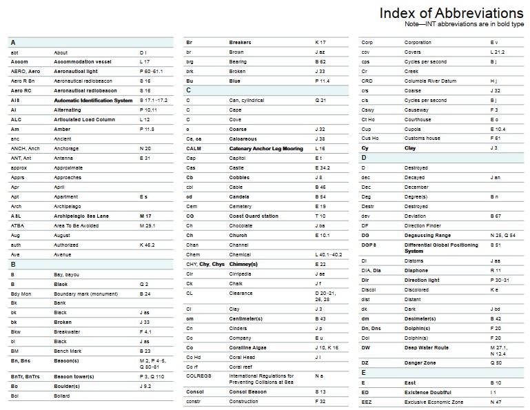
해상 해도(해군 해도/해상 해도)에 사용되는 약어는 무엇입니까? 해저 특성 및 약어 명사 소스 차트 명사 약어 약어 Boulders Blds Blds Clay Cl Cy Coral Co Co Coralhead Cl Hd Cl Hd Gravel GG Grass Grs Grs Mud MM […

필리핀인: 전 세계 해양 부문 선원의 주요 공급원 – 전 세계 선원의 3분의 1이 필리핀인입니다. 1970년대에는 전통적인 해양 국가의 선원 수가 감소하여 인도, 중국, 필리핀 등의 국가로 공급이 이전되었습니다. 필리핀은 중요한 생산국으로 발전 […]

구독 또는 최소 계약 기간이 없고 무료 업데이트 및 수정이 있는 정교한 새 항해도 및 간행물 포털이 출시되었습니다. OpenC247.com은 해양 부문의 디지털 기술에 대한 증가하는 수요에 대응합니다. 포털의 소프트 런칭은 super의 캡틴에서 150명 이상의 등록된 사용자를 끌어들였습니다. […]
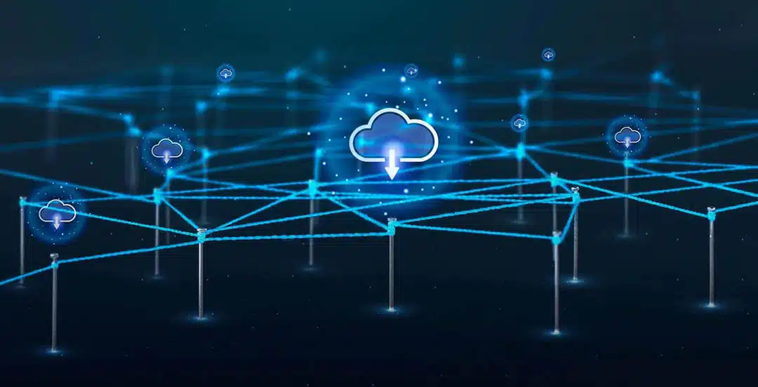
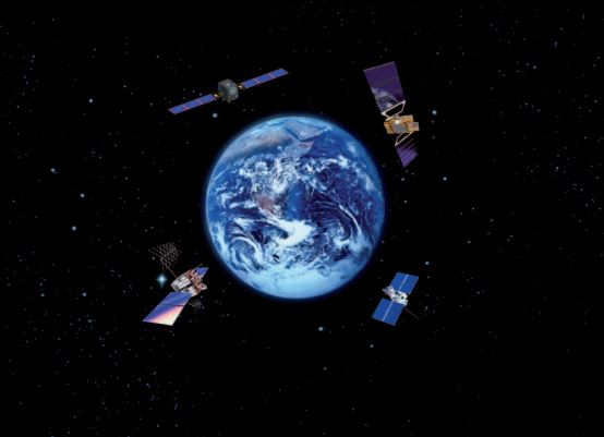
European Digital Twin of the Ocean(European DTO) 이 도구는 바다를 모델링하고 과거와 현재에 대한 지식과 이해를 제공하며 해양의 미래 건강에 대한 신뢰할 수 있는 예측을 생성합니다. ILIAD 컨소시엄은 지구 관찰, 모델링 및 디지털 인프라를 통합하여 바다의 가상 표현을 개발하여 […]
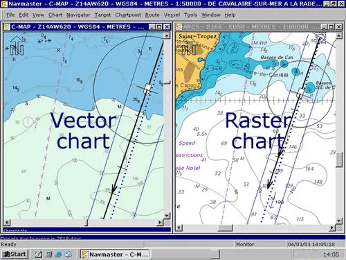
VECTOR와 RASTER 그래픽의 차이점은 무엇입니까? (그래픽과 관련하여 Raster/Vector의 처리 차이 바로 아래 – Vector Nautical Charts(VNC)와 Raster Nautical Charts(RNC)의 차이점에 대해서는 아래를 더 살펴보십시오. 벡터 및 래스터 그래픽. […]
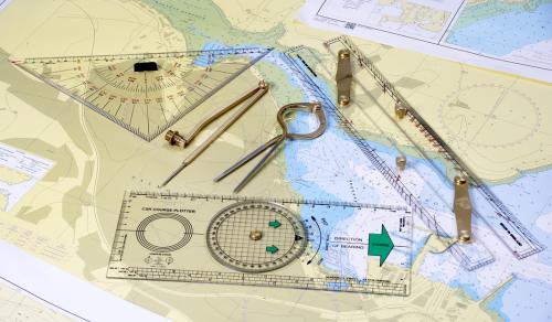
(* 출처: www.sailingissues.com – Diederik Willemsen 작성) 해양 항해 코스(무료) 근해 항해를 위한 해양 항해에 대한 고급 온라인 코스를 찾아보십시오. 오늘날 대부분의 선원은 항법을 위해 GPS/Galileo/GLONASS 및 레이더와 같은 해상 항법 및 위치 확인 장비에 의존하지만 스스로 항행하는 것이 훨씬 더 재미있습니다. 항해를 위한 항법 배우기 […]
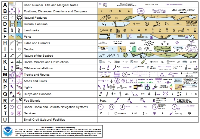
(* 출처: NOAA – 미국 국립해양대기청(National Oceanic and Atmospheric Administration), 미국 과학 및 규제 기관 – 종이 및 전자해도 ENC에 사용되는 기호, 약어 및 용어) 종이 및 전자해도: 기호, 약어 및 용어 사용 해양 항해 해도는 종이 항해 해도에 사용되는 기호의 전체 목록을 참조합니다 […]
GLOSSARY of Nautical Charts, 용어 및 해양 산업에서 사용되는 약어(* 출처: NOAA – 미국 국립해양대기청(National Oceanic and Atmospheric Administration, USA), 미국 과학 규제 기관) 지도 제작(mapping), 해양 차트 작성에 사용되는 용어에 대한 권위 있는 출처 , 및 항해 차트 프로그램에 사용되는 측지학. 용어 및 정의는 특정 지도 제작 […]

안전한 해상 항해 계획을 위한 해상 항법 제품 및 서비스의 모든 최고 제공업체 찾기


