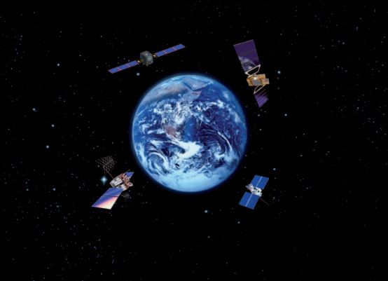
電纜、管道、道路、海峽、航線和衛星構成了全球經濟賴以建立的脆弱網路。這些都是對全球供應鏈和現代生活極為重要的無形網絡,然而,只有當像烏克蘭或以色列這樣的戰爭威脅到這些戰略之一時,人們才會記住這些網絡。
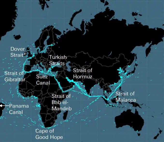
電纜、管道、道路、海峽、航線和衛星構成了全球經濟賴以建立的脆弱網路。這些都是對全球供應鏈和現代生活極為重要的無形網絡,然而,只有當像烏克蘭或以色列這樣的戰爭威脅到這些戰略之一時,人們才會記住這些網絡。
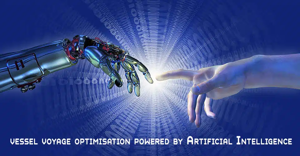
DEEPSEA:由人工智能 (AI) 提供支持的下一代航程優化 使用人工智能 (AI) 性能路由可立即加速船隊的脫碳軌跡,並降低燃料成本。性能路由將對您車隊的燃油消耗和 CII 產生重大的、可量化的影響,從第一天起就產生高影響力的結果。 “DeepSea 船舶航程優化人工智能解決方案可減少排放,[...]
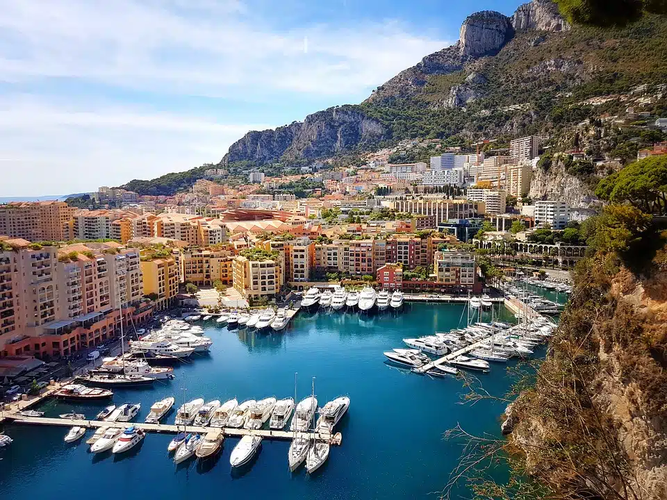
世界最著名的豪華碼頭:哪些是全球最豪華和最受歡迎的碼頭?菲諾港、摩納哥、聖特羅佩、伊維薩島、聖巴特。當我們想到這些地方時,首先想到的畫面之一就是它們的標誌性碼頭。政要、有權有勢的富人、魅力四射的好萊塢明星以及所有製造遊艇的人 […]
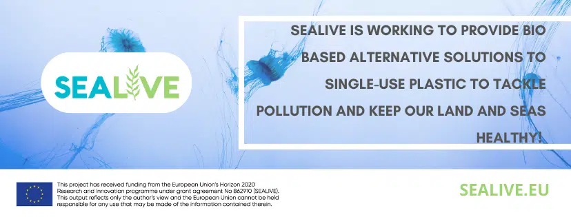
為了地球的利益,漁業正在發生變化——先進的生物基塑料解決方案(作者:Tassoula Eptakili – www.kathimerini.gr)每年有近 1200 萬噸塑料垃圾流入世界海洋。有時它們在水中航行,在水下製造巨大的垃圾堆,有時它們會上岸。盲目消費的影響[...]

谷歌——數據中心 到 2022 年,谷歌加強了其在希臘加速可持續和包容性發展和數字化轉型的承諾,進一步加大了對該國的大力支持。憑藉戰略舉措並以人為本,這家科技公司宣布創建 [...],從而在希臘開啟了重要的新篇章

Lloyd's List 的一百人,對航運業的影響力和權力進行排名即使船東的權力正在減弱,個人行為在航運業中仍然很重要。然而,今年的決定性時刻來自歐盟,它通過採取切實行動應對氣候變化 IT [...]
UKHO 宣布有意終止紙質海圖生產(2022 年 7 月 26 日)(來源:英國海道測量辦公室)英國海道測量辦公室 (UKHO) 於 2022 年 7 月 26 日宣布,它打算制定在年底前退出全球紙質海圖生產的選項2026年增加對其數字導航產品和服務的關注。 (“UKHO […]
自從人們開始建造複雜的東西,他們就意識到需要一個測量系統。最初的基礎是人體。革命的法國要生產出最終的國際單位制(國際測量系統)埃及人使用的肘尺約為 52.4 厘米,但因為 [...]
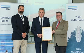
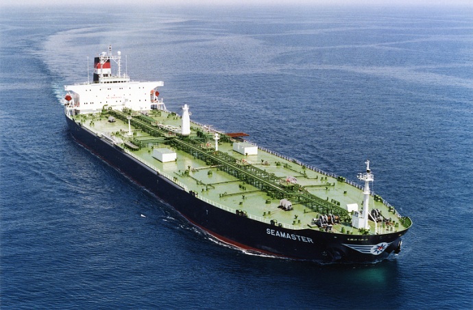
Arcadia Shipmanagement 的 Aegean Myth 被 DNV 認可為第一艘經過驗證的 SEEMP III 船舶船舶運營碳強度計劃或 SEEMP 第三部分是 […] 的一部分
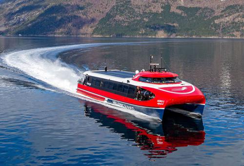
從 2022 年 8 月起,希臘航道的飛翔海豚將載入史冊,這些海豚在過去 5 年裡在 Argosaronicos 海灣運送了數十(如果不是數億)希臘和外國乘客。與大多數人認為夏季嘈雜但快速的車輛有關,而不僅僅是逃逸,主要是在 Argosaronicos,[...]
(海運術語表術語由 Hellenic Shipping News 提供)在您的網絡瀏覽器中按 CTRL + F 彈出搜索欄並輸入您要查找的術語…… Google Play 中的海事詞典應用程序 海事詞典應用程序(應用程序)在谷歌在 Google Play 海軍術語詞典中播放航運詞典(應用程序)[…]
海圖更正和更新 舊的、未更新的(甚至幾週後)海圖絕不能用於海上航行和航行計劃。尤其是海圖上描繪的河流特徵往往會不斷變化,海上或海岸的人工導航設備可能隨時變化。作為一個 […]
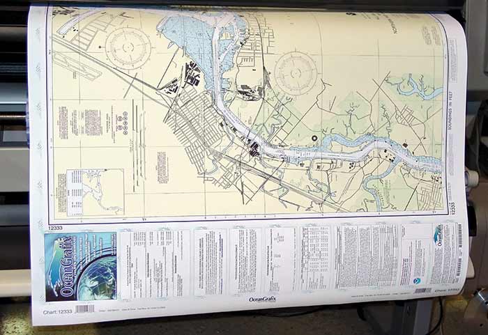
NOAA's Nautical Paper Charts (Raster Nautical Charts: both paper and digital Raster Charts) 即將不再生產(到2025年) 4月13日,美國聯邦政府國家海洋與大氣管理局(NOAA)宣布即將停止印刷傳統海圖平版印刷(紙質)航海圖——而其他形式的航海圖,例如 […]
Web 地圖服務(比較) 最受歡迎的 Web 地圖服務 Google Maps Bing Maps MapQuest OpenStreetMap Here WeGo Apple Maps Yandex Maps 比較列表 功能 Google Maps Bing Maps MapQuest OpenStreetMap Here WeGo Apple Maps Yandex Maps License Proprietary Proprietary ODbL Proprietary Proprietary Proprietary Availability 全部額外功能澳大利亞、加拿大、中國、法國、德國、以色列、意大利、[…]
適用於各種設備的免費(不一定是開源)衛星導航(或“GPS”)軟件目錄。 (帶有免費地圖的導航軟件 - 通常使用來自 OpenStreetMap 項目的地圖) 衛星導航軟件 - 非免費地圖 名稱 公司 設備類型[5] 操作系統 3rd-party GPS-able?[6] 帶有地圖的軟件?跟隨街道?開源?備註 Aqua Map[29] GEC […]
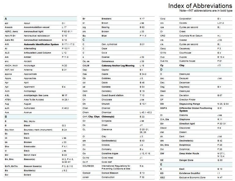
海圖(金鐘圖/海圖)中使用的縮寫是什麼底部特徵和縮寫名詞來源圖表名詞縮寫縮寫巨石 Blds Blds Clay Cl Cy Coral Co Co Coralhead Cl Hd Cl Hd Gravel GG Grass Grs Grs Mud MM [...]

菲律賓人:全球海事部門海員的主要來源——世界上三分之一的海員是菲律賓人。 1970年代,傳統海運國家的海員人數下降,導致供應轉移到印度、中國和菲律賓等國家。菲律賓已發展成為一個重要的生產國 [...]

一個複雜的海圖和出版物新門戶已經啟動,沒有訂閱或最低合同期限,並且免費更新和更正。 OpenC247.com 響應了海事領域對數字技術不斷增長的需求。門戶的軟啟動吸引了 150 多名註冊用戶,來自超級 [...]
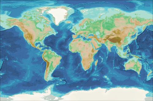
歐洲海洋數字雙胞胎(歐洲 DTO) 該工具將對海洋進行建模,提供對過去和現在的知識和理解,並將對海洋的未來健康狀況做出可信的預測。 ILIAD 財團將開發海洋的虛擬表示,將整合地球觀測、建模和數字基礎設施,以提供 [...]
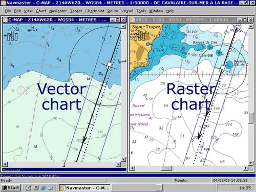
VECTOR 和 RASTER 圖形有什麼區別? (就在其下方處理了關於圖形的光柵/矢量差異 - 請進一步查看下面的矢量海圖(VNC)和光柵海圖(RNC)之間的差異)當談到兩者之間的差異時,許多人會感到有些困惑矢量和光柵圖形。 […]
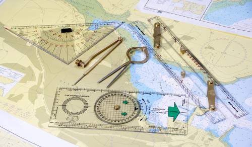
(* 來源:www.sailingissues.com – 由 Diederik Willemsen 撰寫) 海洋導航課程(免費) 查找有關海上航行的海洋導航高級在線課程。儘管如今大多數水手都依賴海上導航和定位設備,例如使用 GPS / Galileo / GLONASS 和雷達進行導航,但自己導航會更有趣,學習導航航行 […]
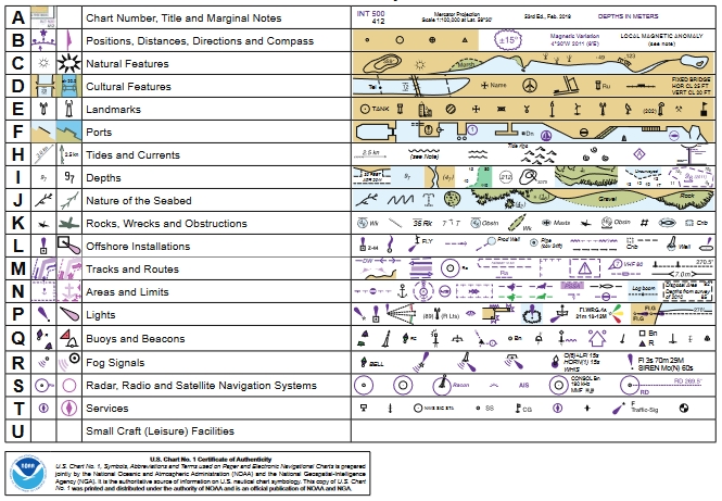
(* 來源:NOAA – 美國國家海洋和大氣管理局(美國),美國科學和監管機構 – 紙質和電子海圖 ENC 上使用的符號、縮寫和術語) 紙質和電子航海圖:符號、縮寫和術語用於Marine Navigation Charts 查看紙質海圖上使用的符號的完整列表 […]
海圖術語表、海運業中使用的術語和縮寫(* 來源:NOAA – 美國國家海洋和大氣管理局,美國科學和監管機構)製圖(製圖)、海圖繪製中使用的術語的權威來源,以及海圖程序中使用的大地測量學。術語和定義是特定的製圖 […]


