Most popular Web Map services
| Google Maps | Bing Maps | MapQuest | OpenStreetMap | Here WeGo | Apple Maps | Yandex Maps |
|---|
Comparison list
| Feature | Google Maps | Bing Maps | MapQuest | OpenStreetMap | Here WeGo | Apple Maps | Yandex Maps |
|---|---|---|---|---|---|---|---|
| License | Proprietary | Proprietary | Proprietary | ODbL | Proprietary | Proprietary | Proprietary |
| Availability | |||||||
| Full extra functionality | Australia, Canada, China, France, Germany, Israel, Italy, Netherlands, Spain, UK, United States. | Andorra, Australia, Austria, Bahrain, Belgium, Canada, Croatia, Czech Republic, Denmark, Finland, France, Germany, Gibraltar, Guernsey, Hong Kong SAR, Hungary, Iceland, Ireland, Isle of Man, Italy, Japan, Jersey, Jordan, Kuwait, Liechtenstein, Luxembourg, Malaysia, Monaco, Netherlands, New Zealand, Norway, Oman, Portugal, Puerto Rico, Qatar, Romania, San Marino, Saudi Arabia, Singapore, South Africa, Spain, Sweden, Switzerland, Taiwan, United Arab Emirates, United Kingdom, United States, Vatican City[1] | United States | All | More than 180 navigable countries | Austria, Belgium, Canada, Denmark, France, Germany, Ireland, Italy, Netherlands, Norway, Spain, Sweden, Switzerland, UK, USA[2] | All[citation needed] |
| Limited extra functionality | Andorra, Austria, Belgium, Brazil, China, Croatia, Czech Republic, Denmark, Finland, Gibraltar, Greece, Hong Kong, Hungary, Ireland, Liechtenstein, Luxembourg, Monaco, New Zealand, Norway, Poland, Portugal, Russia (Moscow only), San Marino, Singapore, Slovakia, Slovenia, South Africa, Sweden, Switzerland, Turkey (Istanbul only) | Bahamas, Cayman Islands, China, Macao SAR, Malta, Virgin Islands[1] | No limited functionality | Voice guided navigation for both pedestrians and drivers for 74 countries in 46 different languages | Argentina, Australia, Austria, Belgium, Brazil, Canada, Chile, China, Colombia, Croatia, Czech Republic, Denmark, Egypt, Finland, France, Germany, Hungary, India, Indonesia, Ireland, Israel, Italy, Jamaica, Japan, Luxembourg, Macau, Malaysia, Mexico, Netherlands, New Zealand, Norway, Peru, Philippines, Poland, Portugal, Russia, Singapore, South Africa, South Korea, Spain, Sweden, Switzerland, Taiwan, Thailand, Turkey, UK, USA, Venezuela, Vietnam[2] | ||
| Directory listings | Australia, Belgium, Canada, China, Japan, Finland, France, Germany, Hong Kong, Ireland, Italy, the Netherlands, Norway, Singapore, South Africa, Spain, Taiwan, the UK, and the United States | Global | None | Argentina, Australia, Austria, Belgium, Brazil, Canada, Chile, China, Colombia, Croatia, Czech Republic, Denmark, Egypt, Finland, France, Germany, Hong Kong, Hungary, India, Indonesia, Ireland, Israel, Italy, Jamaica, Japan, Luxembourg, Macau, Malaysia, Mexico, Netherlands, New Zealand, Norway, Peru, Philippines, Poland, Portugal, Russia, Singapore, South Africa, South Korea, Spain, Sweden, Switzerland, Taiwan, Thailand, Turkey, UK, USA, Venezuela, Vietnam[2] | None | ||
| Officially supported web browsers | IE7+, Firefox 2.0.0.8+, Safari 3+, Mozilla 1.7+, Opera 8.02+, Google Chrome 1+ | IE7+, Firefox 3.6+, Safari 5+, Google Chrome, Mobile Browsers (Internet Explorer, Apple iPhone, Google Android, Research in Motion (RIM) BlackBerry Browser) | IE10, IE11, Chrome, Firefox, Safari (g+) | IE7+, Mozilla Firefox 3.5+, Google Chrome 4+, Safari 4+ | IE7+, Mozilla Firefox 3.5+, Google Chrome 4+, Safari 4+ | None, application-dependent | Internet Explorer 9+, Firefox 2.0.0.8+, Mozilla 1.7+, Opera 8.02+, Google Chrome 1+[3] |
| Officially supported interface languages | Amharic, Arabic, Belarusian, Bengali, Bosnian, Bulgarian, Catalan, Chinese (China and Taiwan), Croatian, Czech, Danish, Dutch, English, English (UK), Filipino, Finnish, French, French (Canada), German, Greek, Gujarati, Hebrew, Hindi, Hungarian, Indonesian, Italian, Japanese, Kannada, Korean, Latvian, Lithuanian, Malayalam, Marathi, Moldovian, Norwegian, Oriya, Persian, Polish, Portuguese (Brazil and Portugal), Punjabi, Romanian, Russian, Serbian (Serbia and Montenegro), Sindhi, Slovak, Slovenian, Spanish, Ukrainian[4] | 117 languages[5] | Dansk, Deutsch, Dutch, English, French, Italian, Norwegian, Portuguese, Spanish, Swedish | 50+ website translations, unlimited map languages | 30 including English, Croatian, Czech, Danish, Finnish, French, German, Greek, Hindi, Hungarian, Icelandic, Indonesian, Italian, Korean, Polish, Portuguese (Brazil), Portuguese, Romanian, Russian, Slovak, Spanish, Swedish, Thai, Turkish | English, Chinese, French, German, Italian, Japanese, Korean, Spanish, Arabic, Catalan, Croatian, Czech, Danish, Dutch, Finnish, Greek, Hebrew, Hungarian, Indonesian, Malay, Norwegian, Polish, Portuguese, Portuguese (Brazil), Romanian, Russian, Slovak, Swedish, Thai, Turkish, Ukrainian and Vietnamese[6] | English, Russian, Ukrainian, Turkish |
Viewing interface | |||||||
| Feature | Google Maps | Bing Maps | MapQuest | OpenStreetMap | Here WeGo | Apple Maps | Yandex Maps |
| Degrees of motion | Vertical, horizontal, depth, rotation (beta), 360 panoramic (Street View), 3D mode (Google Earth JavaScript) | Vertical, horizontal, depth, 360 panoramic (Streetside), 3D mode (tilt, pan, rotate) | Vertical, horizontal, depth | Vertical, horizontal, depth | Vertical, horizontal, depth (zoom), Tilt (3D), rotate 360 degrees | Vertical, horizontal, depth, rotate 360 degrees, 3D | Vertical, horizontal, depth, rotation (mobile version), 360 panoramic, 3D mode |
| Map zoom | 22 (more levels available through parameter) | 19-22 (depending on which map control is used)[7] | 17 | 19 | 18 | Vector-based | 19 |
| Mouse scroll wheel map zoom | Yes | Yes | Yes | Yes | Yes | Yes[8] | Yes |
| Direct mouse interface (draggable, etc.) | Yes | Yes | Yes | Yes | Yes | Yes | Yes |
| Dynamic search results based on dragging on the map | Yes | Yes | No | No | Yes | No | Yes |
| Keyboard shortcuts | Yes | Yes | No | Yes | Yes – routing with directions | No | No |
| Map types | 6: map with traffic data (separate transit and bicycle view), satellite with traffic data (3D LiDar for certain places not present in most places), hybrid | 9: road, satellite, hybrid, bird’s eye, traffic, 3D, London street map, ordnance survey map, venue map | 3: road, satellite, traffic | 5: standard map, transport map, cycle map, humanitarian | 7: map view, satellite, terrain, 3D, traffic, public transportation, heat map, map creator, explore places, community[9] | 3: standard, hybrid, satellite; all include a traffic data layer | 5: standard, hybrid, satellite, traffic, 3D |
| 3D mode | Yes, limited to certain areas | Yes (Windows 8/10) | No | Yes, third-party[10] | Yes, limited to certain areas | Yes, limited to certain areas | Yes (mobile version) |
| 3D landmarks | Yes | Yes | No | No | Yes | Yes | Yes |
| Weather | No | No | Yes, third-party[11] | Yes | Yes | No | |
| Backend | JSON | JSON, XML, JavaScript, .NET | XML | Java, JavaScript | |||
| Backend providers | Microsoft | OpenStreetMap Foundation. Paid for by various individuals and companies. | Nokia/Navteq | Apple | Yandex | ||
| Data | |||||||
| Feature | Google Maps | Bing Maps | MapQuest | OpenStreetMap | Here WeGo | Apple Maps | Yandex Maps |
| Age of satellite imagery | 1–3 years | 1–3 years | 1–4 years | No | 1–3 years | 1–3 years | 1–4 years |
| Map data providers | MAPIT, Tele Atlas, DigitalGlobe, MDA Federal, user contributions | TomTom, OpenStreetMap, Intermap, Pictometry International, NASA, Blom, Ordnance Survey, SK Planet http://www.bing.com/maps/Help/en-us/About.htm | TomTom, OpenStreetMap, and others | User contributions, open data and data donations | Navteq | TomTom, and others | user contributions, NAVTEQ and others[12] |
| Directory data providers | Google+, ThomsonLocal.com | Live Local Listings, Yellow Pages, NAVTEQ, Yelp (ratings and reviews), TripAdvisor (ratings and reviews) | Infogroup (contact info, hours, and description), Yelp (ratings, reviews, and “Good to Know”) | OpenStreetMap Nominatim, GeoNames | Navteq | Yelp (ratings and reviews), others | Yandex.Directory |
| Searching | |||||||
| Feature | Google Maps | Bing Maps | MapQuest | OpenStreetMap | Here WeGo | Apple Maps | Yandex Maps |
| Location | Post code, street name, town, neighborhood, city, plus code long./lat. | Post code, street name, town, neighborhood, city, landmark, administrative district, long./lat. | Post code, street name, town, state, Zip+4 | Post code, street name, town, neighborhood/suburb, state/region, city, country, Zip+4, long./lat. | Post code, street name, town, neighborhood/suburb, state/region, city, country, long./lat. | Post code, street name, town, neighborhood/suburb, state/region, city, country, Zip+4, long./lat. | Post code, street name, town, neighborhood, city, long./lat. |
| Entity | Business, places of interest, airport codes | Airport code, businesses, collections, directories, landmarks, postal codes | Business, places of interest | All possibility, no restriction | Business, places of interest, landmarks, airport codes | Business, places of interest | Business, places of interest |
| User created | Yes | Yes | No | Yes | Yes | No | Yes |
| Levels of filtering | 1 | 0 | 0 | 0 | 0 | 0 | |
| Directions | |||||||
| Feature | Google Maps | Bing Maps | MapQuest | OpenStreetMap | Here WeGo | Apple Maps | Yandex Maps |
| Directions | Yes | Yes | Yes | Yes[13] | Yes – by car, foot, public transport | Yes | Yes |
| Reverse directions | Yes | Yes | Yes | Yes, third-party[14] | Yes | Yes | Yes |
| Public transport integration | Yes limited to certain areas | Yes limited to certain areas[15] | Yes | Yes, third-party[16] | Yes limited to certain areas[17] | Yes limited to certain areas | Yes limited to certain areas |
| Walking directions | Yes | Yes | Yes | Yes | Yes | Yes | Yes |
| Wheelchair directions | Yes, accessibility information | No | No | Yes, third-party[18] | No | No | No |
| Bicycle directions | Yes | No | Yes | Yes | No | Yes | Yes |
| Multiple destinations | Yes | Yes | Yes | Yes, third-party[19] | Yes | Yes, limited to certain types (gas station, cafe) | Yes |
| Send to device | Yes, via email | Yes, via email and Cortana (feature coming in Windows 10 anniversary update) | Yes, via email, SMS, Car, GPS, Facebook | No | Yes, via synchronization | Yes, via handoff, link sharing, or airdrop | Yes, via email |
| Live traffic information | Yes | Yes (35 countries)[20] | Yes | Yes, partial in a third-party[21] | Yes | Yes | Yes |
| Historic traffic | Yes | No | No | No | Yes | No | Yes |
| Personalization | |||||||
| Feature | Google Maps | Bing Maps | MapQuest | OpenStreetMap | Here WeGo | Apple Maps | Yandex Maps |
| Set home location | Yes | Yes | Yes | Yes, if registered | Yes | Yes | Yes |
| Save maps | Yes | Yes | No | No | Yes | Yes | Yes |
| Printing | |||||||
| Print option | Yes | Yes | Yes | No | Yes | Yes | Yes |
| Scale to print | No | No | No | No | No | Yes | Yes |
| Crop to print | Yes | Yes | No | No | Yes | Yes | Yes |
| Notes | Yes | Yes | Yes | No | Yes | No | Yes |
| Retains overlays? | Matched searches, directions | Matches searches, directions, collections | No | Marker | Favourites, directions | Matched searches | Favourites, directions |
| Collaboration / embedding | |||||||
| Create hyperlink | Yes | Yes | Yes | Yes, both permalink and shortlink | Yes | Yes | Yes |
| Send hyperlink to email | Yes | Yes | No | No | Yes | Yes | No |
| Embed HTML Iframe link | Yes | Yes | Yes | Yes | No | Yes, when sent via iMessage | No |
| Application integration | Google Earth, BMW Assist, Tesla Navigation | Windows 8/10, Windows Phone 7/8/10, Microsoft Office (Access, Outlook, Excel – Power View, Power Maps, Power BI), Microsoft SQL Reporting Services, Microsoft Dynamic CRM, Microsoft SharePoint, Microsoft Cortana, Bing Weather, Microsoft Research WorldWide Telescope, AutoCad, ESRI ArcGIS | Apple Maps, MapQuest, Foursquare, Craigslist, Apple iPhoto, Wikipedia, World Bank | Mercedes-Benz in-car system, Alpine in-car system | CarPlay | In Car System,[22] Yandex.Navigator, Yandex.Trafic, Yandex.Transport, Yandex.Schedules | |
| API available | Yes | Yes – Javascript, WPF, .NET (C#, VB), C++, Windows 8/10, WP 7/8, REST | Yes | Yes | Yes – developer.here.com | Yes – developer.apple.com/reference/mapkit | Yes |
| Other | http://microsoft.com/maps Blog http://blogs.bing.com/maps | WordPress plugin / open search | |||||
| Shareable maps | Yes | Yes Via Email, Facebook, Twitter | No | Yes | Yes | Yes | No |
| Readily available overlays | Yes | Yes | Yes | No | No | No | Yes |
Advertising | |||||||
| Feature | Google Maps | Bing Maps | MapQuest | OpenStreetMap | Here WeGo | Apple Maps | Yandex Maps |
| Business advertising | Yes | Yes – Microsoft consumer apps, not in B2B apps or APIs | No | No | Yes | No | Yes |
| Mobile | |||||||
| Mobile-specific website | Yes | Yes | Yes | Yes | Yes[23] | No, application dependent | Yes |
| Mobile-specific application | Yes | Yes | Yes | Android only via OsmAnd and STAPPZ[24] | Yes, for Nokia mobile phones and iOS and Android | Yes | Yes |
| Contact integration | Yes | Yes | No | No | No | Yes | Yes |
| Voice integration | Yes, via Android Maps app, upcoming feature for full web mode | Yes | No | Yes, with OsmAnd | Yes | Yes | Yes |
| GPS integration | Yes | Yes | Yes | Yes | Yes | Yes | Yes |
| Directions | Yes | Yes | Yes – with OsmAnd | Yes | Yes | Yes | |
| Turn-by-turn navigation | Yes, if on Android | Yes – Windows 10 | Yes | Yes, with OsmAnd | Yes | Yes | Yes, if on mobile version |
| Interactive maps | Yes | Yes | Yes | Yes, in custom implementations e.g. via STAPPZ[24] for Android | Yes | Yes | Yes |
| Types of map | Map, satellite, terrain, street | Road, satellite, hybrid, bird’s eye, traffic, 3D, London street map, ordnance survey map, venue map | Map, satellite | Map, terrain, satellite (exclusive to editing) | Map, satellite, terrain, 3D with plugin, 3D without plugin for compatible browsers, night mode | Map, satellite, terrain, hybrid, flyover, 3D | Map, satellite, hybrid, 3D |
| Cell-based location | Yes | Yes | Unknown | Unknown | Yes | Yes | Yes |
| Wi-fi location | Yes | Yes | Unknown | Yes | Yes | Yes | Yes |
| Supported languages | 54[25] | 117[5] | 4 |
Visit: https://en.wikipedia.org/wiki/Comparison_of_web_map_services for the full article
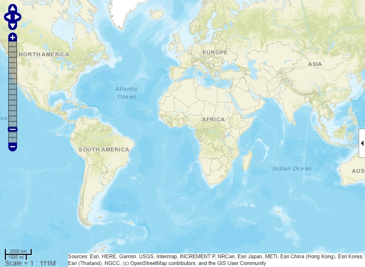
These maps cover the world, but may have insufficient details in some areas.
See also: (Free) offline Satellite Navigation Software – a comparison – https://marine-charts.com/satellite-navigation/free-offline-satellite-navigation-software-comparison/


Find all top providers of Marine Navigation products & services for safe Maritime Voyage Planning