Cables, oleoductos, carreteras, estrechos marítimos, rutas aéreas y satélites forman la frágil red sobre la que se construye la economía global. Se trata de redes invisibles de enorme importancia para la cadena de suministro global y la vida moderna, que, sin embargo, sólo se recuerdan cuando una guerra como la de Ucrania o Israel amenaza uno de estos puntos estratégicos. Un estudio del Deutsche Bank arroja luz sobre los cinco eslabones débiles de la economía global. Es decir, las infraestructuras que no pueden ser reemplazadas por alguna alternativa y por tanto, pueden bloquear la cadena de suministro global.
Hay algunas vulnerabilidades en la economía global que son más o menos conocidas por todos, como las fábricas de semiconductores de Taiwán, los centros financieros globales y las 0,5% de las estaciones de metro de Londres y París que podrían bloquear la media red.
Pero también están las redes invisibles pero muy importantes, como lo demostró el daño causado a un gasoducto submarino y a un cable de telecomunicaciones entre Finlandia y Estonia el 10 de octubre, que recuerda al sabotaje del gasoducto Nord Stream hace un año. En 2010, la erupción de un volcán en Islandia "inmovilizó" un segundo del tráfico aéreo europeo durante ocho días, señala el Deutsche Bank.
Tanto Ucrania como Israel se encuentran cerca de puntos tan importantes para la economía global.
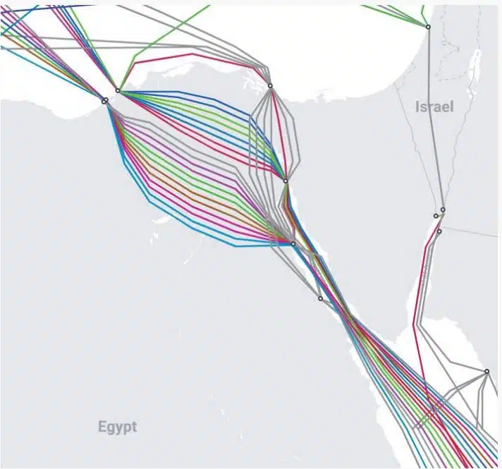
– Cables de datos: Hasta 99% de las comunicaciones digitales del mundo, así como 10 billones de transacciones financieras. dólares, pasan a través de cables de fibra óptica ubicados en el fondo del mar. Hay aproximadamente 550 cables activos y planificados, que abarcan 1,4 millones de kilómetros. Muchos son apenas más gruesos que una regadera, explica el Deutsche Bank. Estos cables son vulnerables al espionaje, al sabotaje y a daños accidentales.

– Cables eléctricos submarinos: Los interconectores de energía permiten a los países comprar energía eólica o solar más barata a sus vecinos con un clima más favorable, aumentando la seguridad del suministro y gestionando mejor la demanda. Pero pueden ser destruidos por sabotaje o accidente.
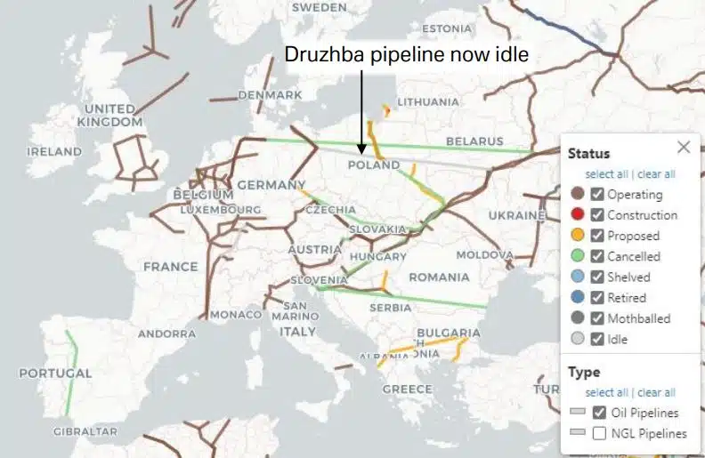
– Gasoductos de gas natural: Europa depende de los gasoductos para la mayor parte de su suministro de gas natural. En 2020 importó casi 40% de su gas natural de Rusia y, desde entonces, ha tenido que depender de gasoductos de Noruega e importar GNL. Como demostraron las explosiones de Nord Stream, estos oleoductos son vulnerables al sabotaje.

– Oleoductos: La mayoría de los oleoductos del mundo están ubicados en Europa y Asia y parten de Rusia. Un oleoducto típico tiene unos 50 centímetros de diámetro y puede transportar más de 1 millón de litros (o 6.300 barriles por hora). En comparación, un barril puede transportar menos de 200 barriles a la vez. Las tuberías están hechas de acero y, cuando es posible, están enterradas en el suelo. Al igual que los gasoductos naturales, son vulnerables a daños, terremotos y sabotajes.
Algunos ferrocarriles y carreteras en lugares remotos transportan una proporción desproporcionadamente grande de suministros críticos para la economía global, sin alternativas. Una vasta zona en el Congo y Zambia, por ejemplo, es el mayor productor de cobre de África y representa dos tercios de la producción mundial de cobalto. Pero sólo hay cuatro carreteras, todas malas y congestionadas, para transportar estas materias primas desde las minas hasta los puertos de Namibia, Sudáfrica, Mozambique y Tanzania. Algo similar está sucediendo con la soja de Brasil, que es el primer exportador del mundo. En los últimos dos años, la sequía ha afectado a ríos que son vías fluviales vitales, lo que demuestra cuán vulnerables son estos transportes.
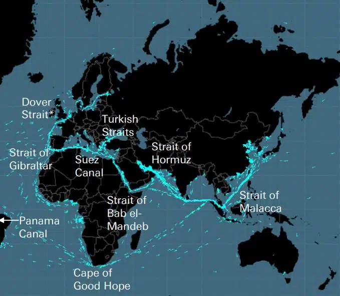
Junto con el Cabo de Buena Esperanza, existen 8 “estrechos” importantes para el transporte marítimo. Según explica Deutsche Bank, estas son las cinco “llaves que abrieron el mundo” para el Imperio Británico, si se elimina el estrecho de Dover y se añade el canal de Panamá, el estrecho de Turquía, el estrecho de Bab el Madeb y el estrecho de Ormuz. . En petróleo, por ejemplo, más de 60% de suministro se transportan por vía marítima, siendo el Estrecho de Ormuz el punto más importante para el mercado, ya que por él pasa una quinta parte del consumo mundial (y un tercio del GNL). En su punto más estrecho, el estrecho de Ormuz tiene sólo 33 kilómetros de ancho.
Estos estrechos son vulnerables a bloqueos, colisiones o encallamientos de barcos, piratas, ataques terroristas, guerras y accidentes como derrames de petróleo.
El transporte aéreo depende de una red invisible de corredores que pueden verse perturbados por el clima, guerras o acontecimientos inusuales, como cuando se cerró el espacio aéreo español en noviembre pasado para permitir que un misil chino entrara en la atmósfera terrestre. Las huelgas de los controladores aéreos han causado importantes problemas de transporte en Europa este año, mientras que el mayor bloqueo del tráfico aéreo de la posguerra se produjo en 2010, cuando el volcán de Islandia entró en erupción.
El mundo depende en gran medida del Sistema de Posicionamiento Global (GPS) de EE. UU. Utiliza aproximadamente 30 satélites de posicionamiento, navegación y sincronización (PNT) en órbita terrestre, que envían señales a más de 4 mil millones de usuarios en todo el mundo. Pero estas señales son débiles y propensas a sufrir interferencias, y se ha estimado que si se “corta” el GPS, el costo superará los $1 mil millones por día, sólo para Estados Unidos.
(FUENTE: https://www.moneyreview.gr/business-and-finance/125480/deutsche-bank-ta-aorata-diktya-poy-kinoyn-tin-pagkosmia-oikonomia-oi-5-adynamoi-krikoi/)


Encuentre todos los principales proveedores de productos y servicios de navegación marítima para la planificación segura de viajes marítimos