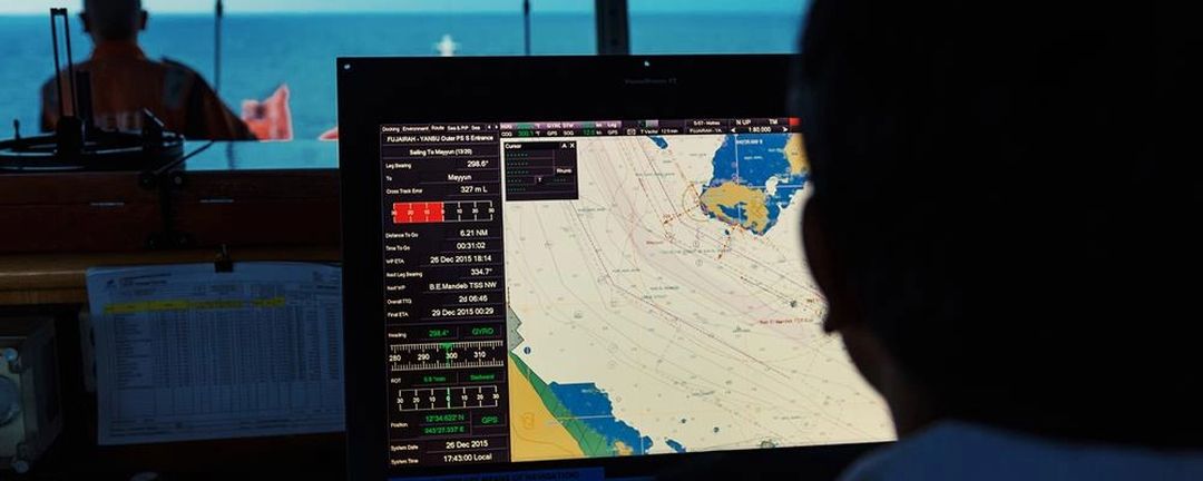
The Electronic Chart Display and Information System is a specialized digital navigation computer, and an alternative to paper charts. It stores a set of Electronic Navigation Charts (ENCs) and/or Raster Charts, which can display all the necessary geographic information a crew needs to complete a voyage. However, an ECDIS isn't simply a digitized replacement for traditional charts.
ECDIS charts typically incorporate much more information than past navigation tools, and automate many essential functions. For instance, the navigator now has a much lighter burden thanks to automatic route planning and monitoring. While route correction once consumed much of a navigation officer's time, it's a thing of the past with a working ECDIS. The precision, consistency and reliability of electronic navigation represents a boon to safety, efficiency and profitability in maritime navigation.
The ECDIS works by incorporating robust, specialized electronic navigation software with many modern navigational tools. This includes fixtures such as GPS, RADAR, ARPA and numerous others. You can use your ECDIS to access information from these sources, check Tide Tables and check virtually all relevant navigational information.
By using ENC's, the ECDIS is able to ascertain precise depth information and early-warning on any potential hazards along the naval route. A ship crew can gain even more precise information by calculating and inputting figures such as squat, which can pull a ship closer to the seabed. This information feeds into several other automated functions, providing for extremely accurate route safety judgments and automated safety warnings.
(SOURCE: AMnautical.com - All about the Electronic Chart Display and Information System)

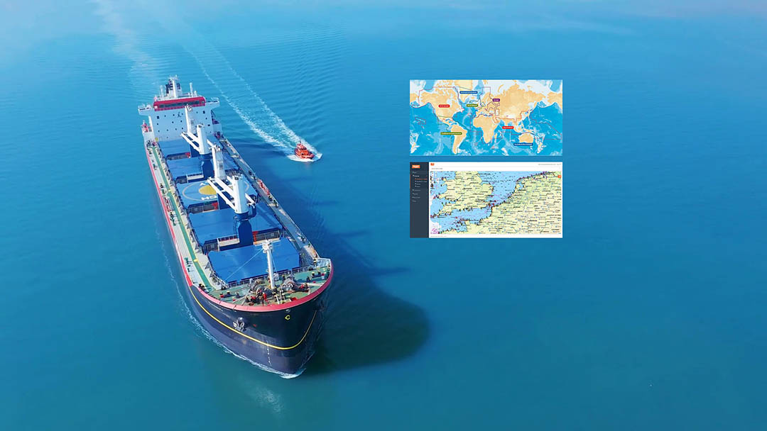
list of the best marine Electronic Chart Display and Information Systems (ECDIS), geographic information systems (GIS) used for nautical navigation that complies with International Maritime Organization (IMO) SOLAS regulations as an alternative to paper nautical charts - marine navigation systems


Ships have long been required to carry standard nautical charts (paper nautical charts PNCs) and nautical publications to plan and display the ship's route for the intended voyage and to plot and monitor positions throughout the voyage. The advent of electronic navigational charts (ENCs) in the 1990s provided ships with additional information, including real time information which could be displayed on screens on Electronic Chart Display and Information Systems (ECDIS). IMO adopted performance standards for electronic charts in the 1990s. In 2000, IMO adopted the revised SOLAS regulation V/19: carriage requirements for shipborne navigational systems and equipment to allow an ECDIS to be accepted as meeting the chart carriage requirements of the regulation. Recognizing the advantages of ECDIS for navigation, in 2009, IMO adopted further amendments to regulation V/19, to make mandatory the carriage of ECDIS. The amendments entered into force on 1 January 2011, making ECDIS mandatory for new ships built after set dates and also phasing-in the requirement for existing ships.
(Source: International Maritime Organisation - www.imo.org)
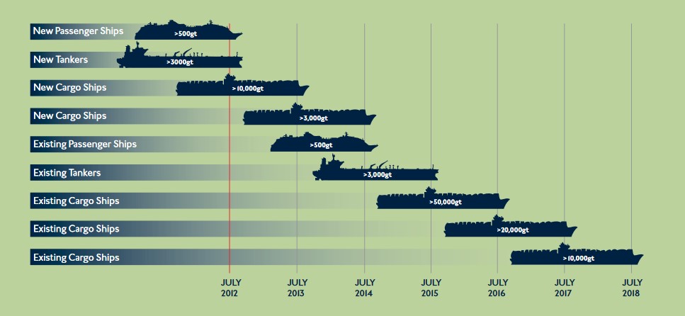
The amended SOLAS regulation V/19 requires all newly built passenger ships of 500 gross tonnage and upwards, as well as newly built cargo ships of 3.000 gross tonnage and upwards engaged on international voyages to be fitted with ECDIS. For existing ships, phase-in introduction of fitting requirements are being introduced for all ships of certain size engaged on international voyages (See SOLAS regulation V/19.2.10).
In more detail - Carriage requirements for ECDIS:
The International Maritime Organization (IMO), at the 86th session of the Maritime Safety Committee (MSC) in June 2009, approved amendments to the International Convention for the Safety of Life at Sea (SOLAS) requiring ships to be fitted with an Electronic Chart Display and Information System (ECDIS). The amendment to SOLAS means that all large passenger, cargo and tanker ships will have to be fitted with ECDIS on a rolling timetable - that begun in July 2012:
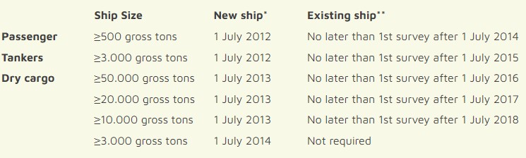
* A new ship is defined as one in which the keel is laid on or after the cut-off date
** Ships may be exempted from these requirements if they will be taken permanently out of service within two years of the implementation date specified
ECDIS has been designed by IMO to enhance safety of navigation at sea, and it is the only system that may be approved, when operating on official ENCs, for paperless navigation.
What steps to take towards your ECDIS compliance?
- stage 1. identify key SOLAS compliance dates for your fleet
- stage 2. conduct an initial ECDIS risk assessment
- stage 3. plan for ECDIS training
- stage 4. ensure correct ECDIS installation
- stage 5. establish safe, efficient ECDIS operating procedures
- stage 6. ensure you’re using up-to-date ENCs
- stage 7. conduct individual ship ECDIS risk assessment
- stage 8. make the transition from paper charts to ECDIS
- stage 9. implement ECDIS onboard
(New ECDIS regulations - the full guide to meeting the revised SOLAS requirements, provided by ADMIRALTY.co.uk: Download ECDIS guide)
What is Electronic Chart Display and Information System (ECDIS)?
Electronic Chart Display and Information System (ECDIS) - Wikipedia
Electronic Nautical Charts (ENC) and Electronic Chart Display and Information Systems (ECDIS) - IMO
What are the benefits of Electronic Chart Display and Information Systems?
ECDIS - overview of carriage requirements and training requirements
Electronic Navigational Charts
ECDIS: Symbols, Abbreviations & Terms
Navigation at sea with ECDIS: advantages, drawbacks, and requirements
SOLAS requires certain ships to meet International Maritime Organization (IMO) provisions defined in the 1974 International Convention for the Safety of Life at Sea (SOLAS,) together with its amendments.
IMO SOLAS V/19 outlines requirements for the types of charts ships are required to carry:
2.1 All ships irrespective of size shall have:
2.1.4 Nautical charts and nautical publications to plan and display the ship’s route for the intended voyage and to plot and monitor positions throughout the voyage. An electronic chart display and information system (ECDIS) is also accepted as meeting the chart carriage requirements of this subparagraph. Ships to which paragraph [2.10] applies shall comply with the carriage requirements for ECDIS detailed therein;
2.1.5 Back-up arrangements to meet the functional requirements of subparagraph 2.1.4, if this function is partly or fully fulfilled by electronic means*;
Footnote to regulation 2.1.4
*Paper nautical charts sufficient to meet the requirements of sub-paragraph .4 and regulation 27 may be used as a back-up arrangement for ECDIS. Other back- up arrangements for ECDIS are acceptable (see Appendix 6 to resolution MSC.232 (82), as amended.)
A majority of cargo ships, tankers, passenger ships, and mega yachts use electronic chart display and information systems (ECDISs). An amendment to SOLAS requires these vessels to use ECDIS as a primary means of navigation. By 2018, all such vessels will be required to use ECDIS.
It is not enough for a vessel to simply have an ECDIS on board. To be in compliance with SOLAS regulations and to pass port state inspections the ECDIS on a vessel must contain the appropriate Electronic Navigational Charts (ENCs) for the vessel's intended voyage. There are two types of electronic nautical charts that an ECDIS can display: Raster Navigational Charts (RNCs) and Electronic Navigational Charts (ENCs - also known as vector nautical charts VNCs)
(SOURCE: AMnautical.com: ECDIS (Electronic Chart Display & Information System) & official chart requirements - https://www.amnautical.com/blogs/news/17037716-ecdis-vector-charts-raster-charts )
ECDIS - IN SUMMARY:
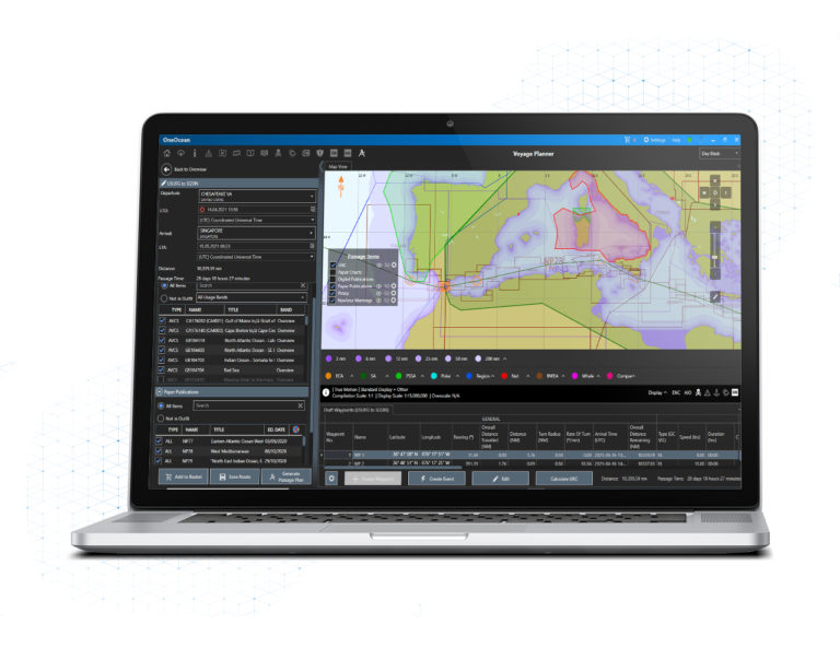
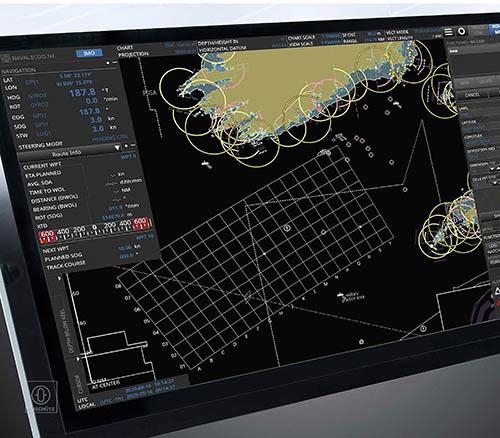
The Electronic Chart Display and Information System (ECDIS) is much more than a charting program — it’s an integrated navigational system designed as an approved alternative to Nautical Paper Charts. The system displays either Raster Navigational Charts (RNCs - Paper Charts) or Electronic Navigational Charts (ENCs - Digital Nautical Charts) and usually is connected to the ship’s Radar / ARPA, AIS, gyro, speed log, Depth Sounder, and GPS receiver. ECDIS also displays information such as tide tables and sailing directions, weather, ice conditions, and vessel track.
ECDIS units allow the vessel to comply with IMO Regulation V/19 & V/27 of the SOLAS convention as amended, by displaying selected information from a System Electronic Navigational Chart (SENC). ECDIS equipment complying with SOLAS requirements can be used as an alternative to paper charts, but it’s not enough for a vessel to simply have an ECDIS on board. To be in compliance and to pass a Port State or Class inspection, the ECDIS must contain the appropriate electronic charts for the vessel’s intended voyage, be installed with type-approved hardware and software, must be maintained and have an approved backup, and the vessel must maintain the officers’ training record
(SOURCE: Dockwalk.com - Capt. Ted Morley)
a complete guide to what is ECDIS (a Marine Electronics & Communication magazine editorial on Summer 2011)
ECDIS - a buyers guide (by Admiralty.co.uk)
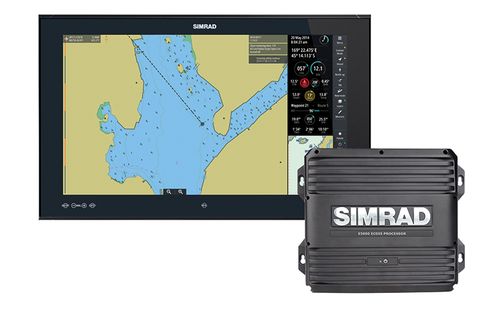
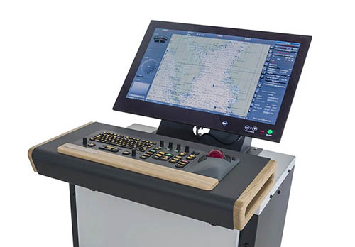
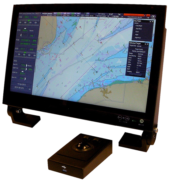
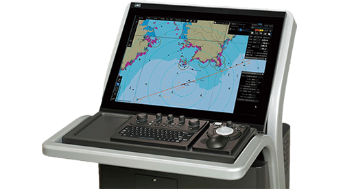
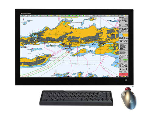
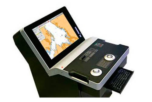
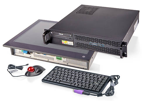
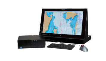
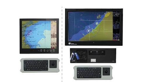
List of best and popular ECDIS products (electronic Chart Display and Information Systems) for Maritime Navigation
Hydrographic Dictionary - Glossary of ECDIS Related Terms - Inserted in database version
SOLAS regulations V/18 and V/19, requires that in order to achieve chart carriage requirements (in terms of SOLAS), the ECDIS equipment must conform to the relevant IMO performance standards. ECDIS units on board are required to comply with one of two performance standards (either IMO resolution A.817(19), as amended; or resolution MSC.232(82)), depending on the date of their installation.
See also Information on IHO Standards related to ENC and ECDIS for additional information on IHO standards that are relevant to ENC provision and ECDIS carriage requirements.


Find all top providers of Marine Navigation products & services for safe Maritime Voyage Planning